| Altitude | 931 Feet |
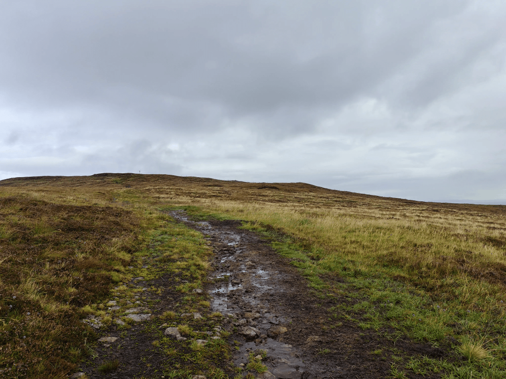
| Trail Conditions | Boggy access track |
| Difficulty | Low |
| Experience | 6/10 |
| Est. Time | 1-2 hours |
| Distance | 2-3 Miles |
| Starting Location | Knockbrek Primary School |
History of the Local Area
The local area surrounding Ben Geary sits on the Waternish Peninsula, a place steeped in the violent and compelling history of the Clan feuds that dominated Skye for centuries. This particular region was the historic frontier between the powerful Clan MacLeod (who held Waternish) and the Clan MacDonald of Trotternish. Your walk, though peaceful today, directly traverses the area where one of the most famous and brutal battles of these feuds took place.
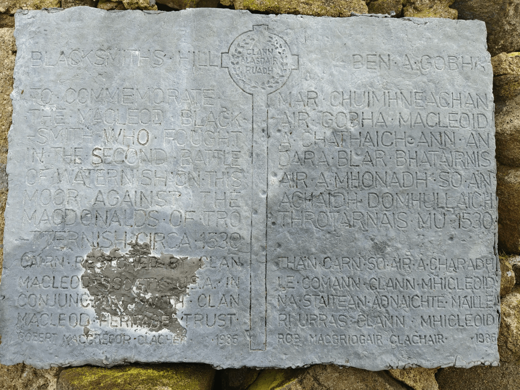
The prominent Blacksmith’s Hill Memorial Cairn, which you visit on the suggested loop, stands as a testament to the Second Battle of Waternish in 1530. This encounter occurred after the MacDonalds had launched a destructive raid on the MacLeod lands. The MacLeods, led by the Chief’s brother, ambushed the retreating MacDonalds, leading to a bloody engagement. The cairn honours the courage of the MacLeod Blacksmith who fought and fell on this ground. The battle was a resounding defeat for the MacDonalds, who suffered heavy losses as they attempted to flee the peninsula.
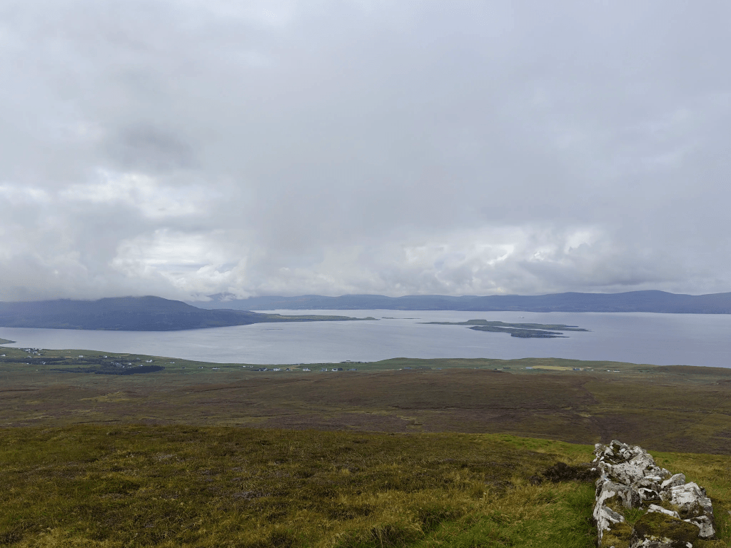
Even the path you follow, the work tracks leading to the summit mast, follows a trajectory that has been important to the people of Waternish for generations. The ridge line of Ben Geary has always offered a natural vantage point, providing clear sightlines over the coastline and the Minch, crucial for both monitoring grazing animals and for watching for the approach of hostile ships from the Outer Hebrides. Thus, your modern utility track follows the ancient, strategic line of sight that has defined this frontier landscape for over 500 years.
The Cairn which marks the spot reads “To commemorate the Macleod Blacksmith who fought in the second battle of Waternish on this moor against the Macdonalds of Trotternish circa 1530. Cairn restored by Clan Macleod Society USA in conjunction with Clan Macleod Heritage Trust. – Robert MacGregor Clacher 1985”
Gallery

The Walk
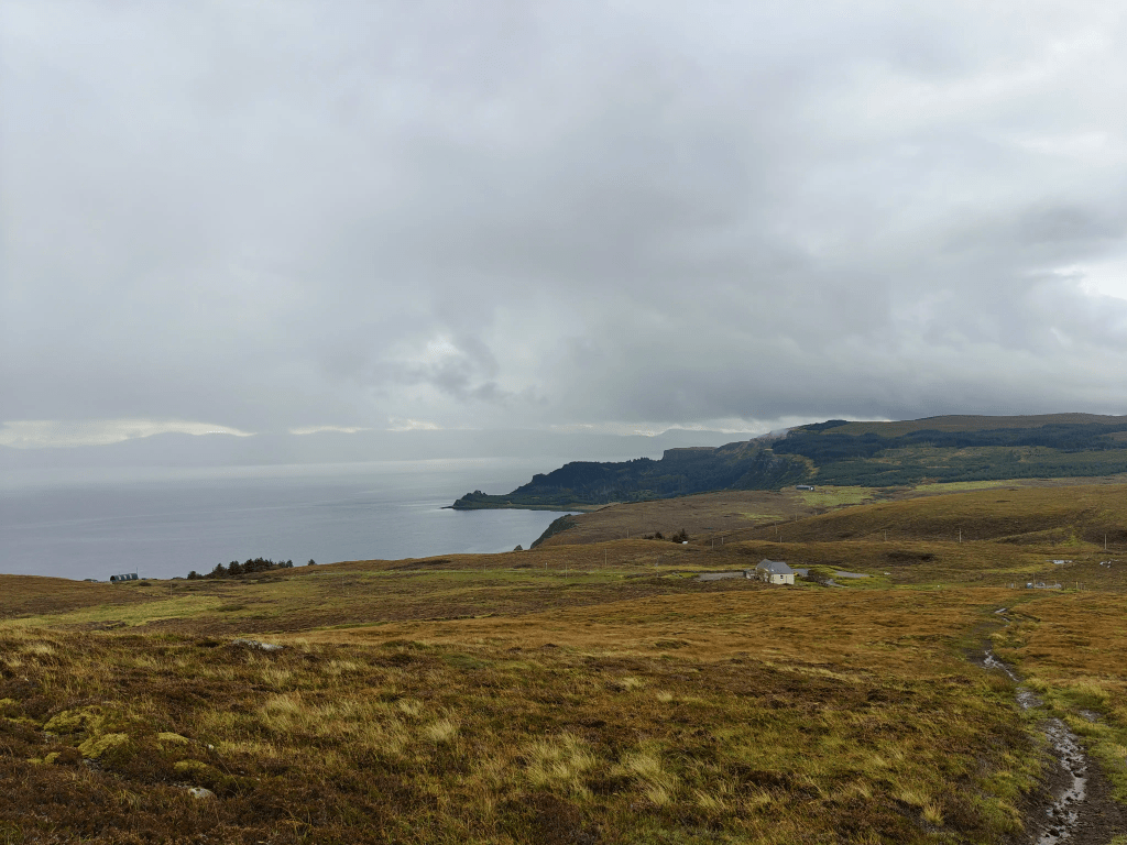
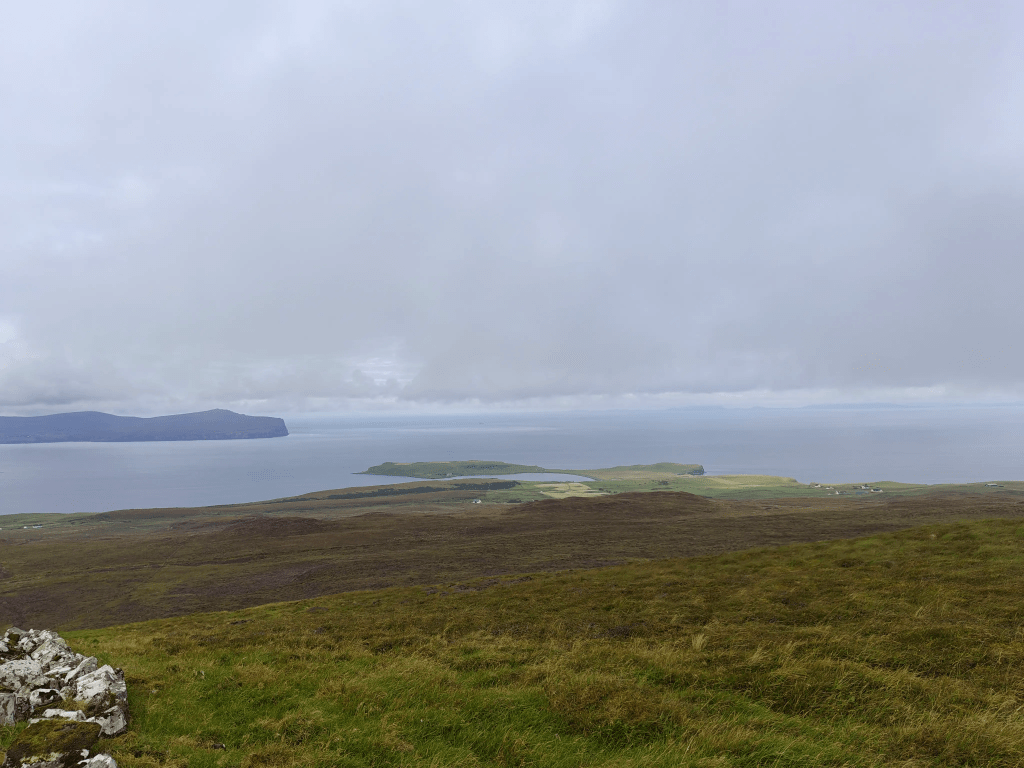
Ben Geary offers one of the most accessible trig point walks in the north of Skye, rewarding hikers with panoramic views over the Waternish peninsula. The summit is easily identified by the presence of a large metal communications tower, which serves as a guiding landmark throughout the ascent.
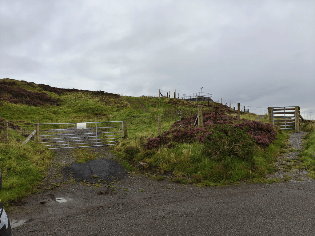
To begin this walk, park at the turnoff to the utilities area just before reaching Knockbreck Primary School, ensuring that you do not obstruct any access gates. If your walk is outside of normal school hours, the Primary School car park may also be a viable option.
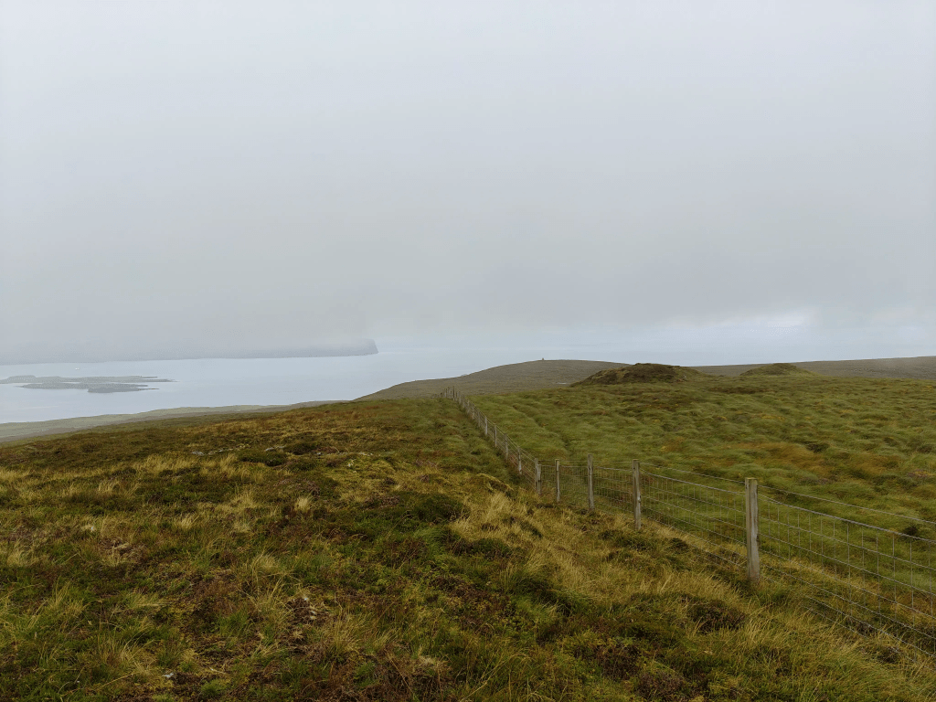
Once parked, go through the gate to the north and join the occasionally subtle tracks left by the work vehicles accessing the communications tower on the summit of Ben Geary. Following these tracks is key, as they allow you to navigate and dodge the worst of the boggy ground, though care must still be taken as the surface can be slippy underfoot in wet conditions.
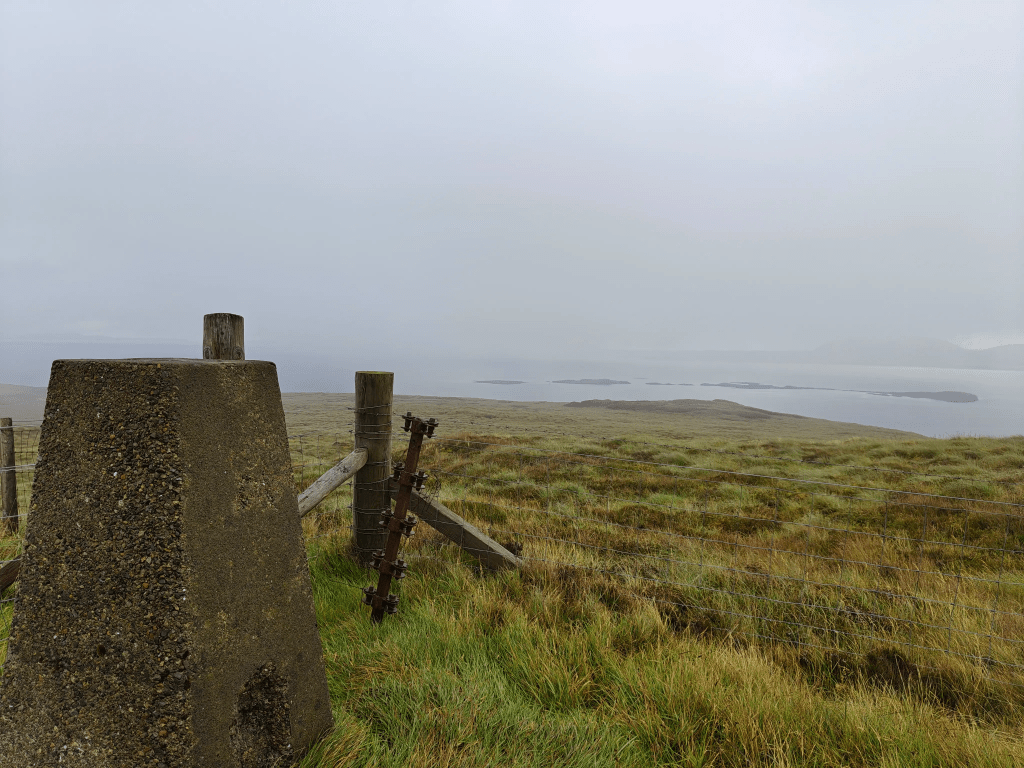
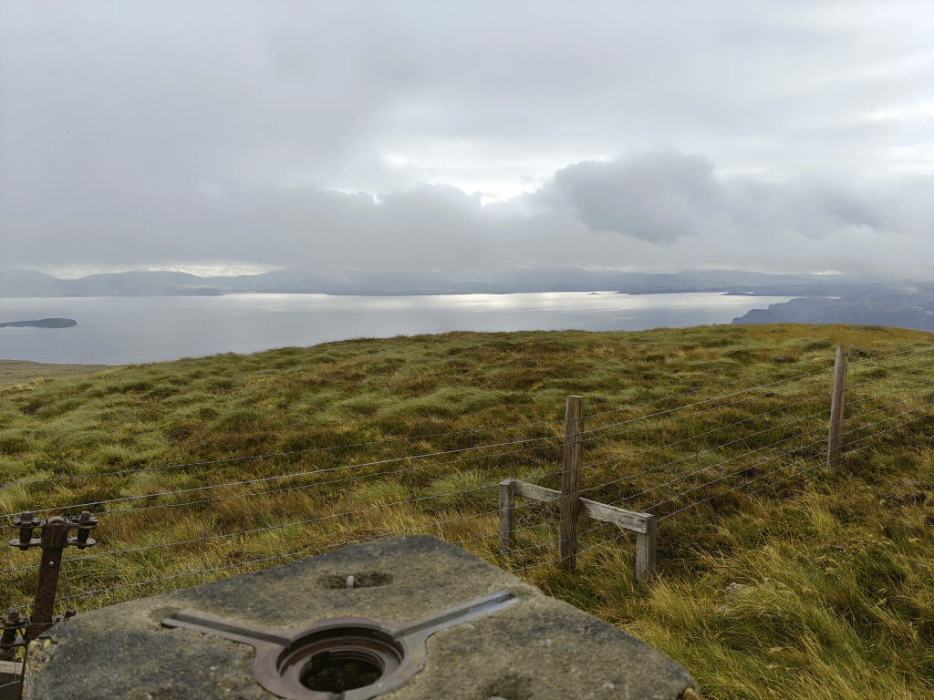
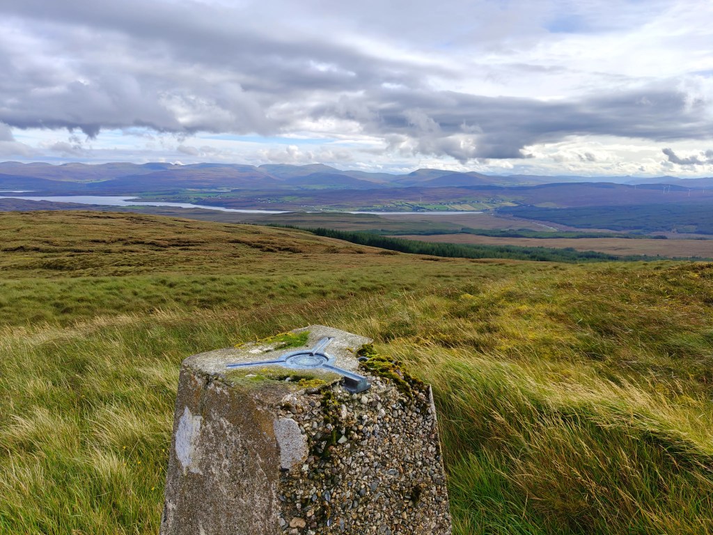
Continue following the vehicle tracks as they steadily ascend the hill toward the prominent tower. Once you reach the tower itself, the Trig Point is located just behind the structure, precisely where the two main boundary fences converge. From this spot, you can fully appreciate the immediate surroundings and the vast expanse of the Minch sea.
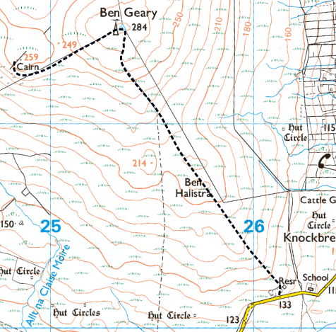
From the trig point, you have the choice to follow the tracks straight back to your starting point, or, as is highly recommended, extend the walk for a historical detour. For the recommended loop, follow the west-bound fenceline for a short distance until you spot a large, distinctive stone cairn to the north-west. Cross over the fence at a convenient point and climb a short, gentle rise to reach the Blacksmith’s Hill Memorial Cairn. This impressive, modern tribute honours a Macleod Blacksmith who bravely fell during the Second Battle of Waternish against the MacDonalds of Trotternish in 1530, connecting this peaceful hilltop to a vital moment in Clan history.
Once you have taken in the panoramic sights from the memorial, you can either retrace your exact path back to the telephone mast and rejoin the work tracks, or you may choose to take a more direct, straight-line route across the thick heather to cut back to the tracks

Leave a comment