| Altitude | 2358 Feet |
| Trail Conditions | Well-defined trail followed by gravel/bog sections |
| Difficulty | Medium/High |
| Experience | 10/10 |
| Est. Time | 3-5 hours |
| Distance | 7-8 Miles |
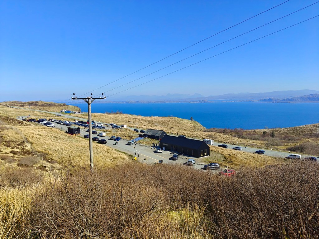
| Starting Location | Storr Car Park |
History of the Local Area
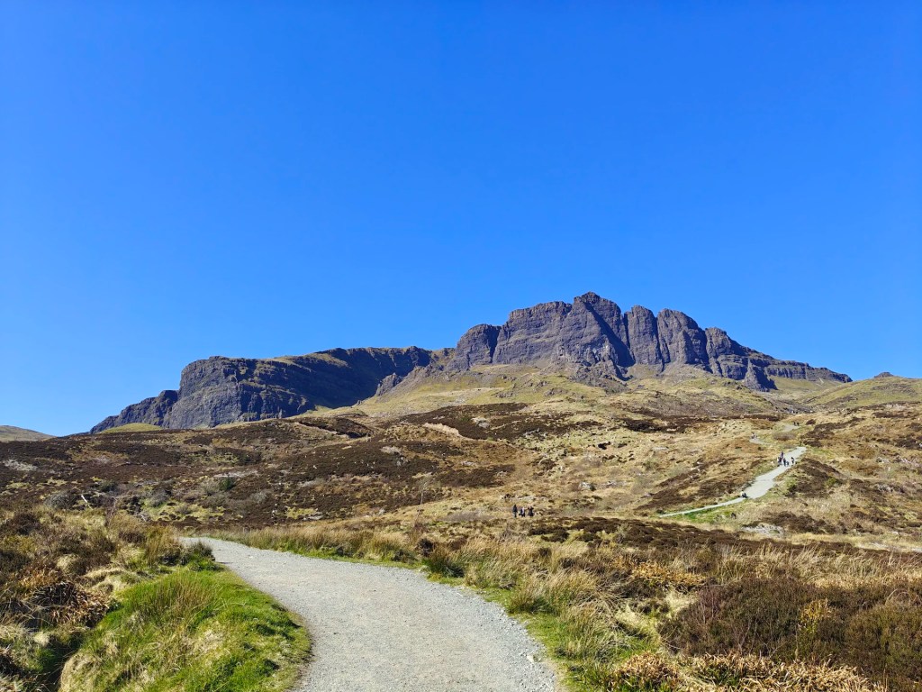
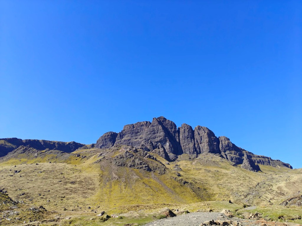
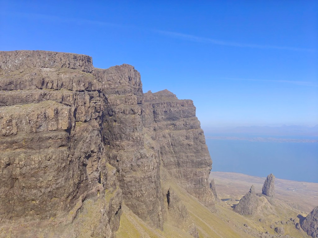
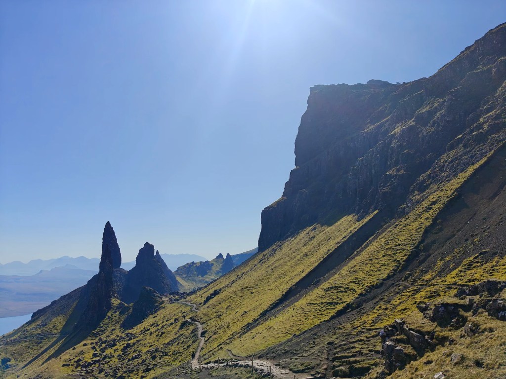
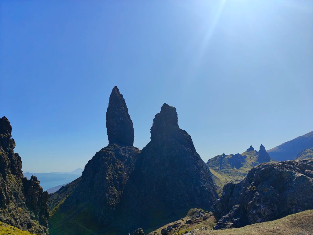
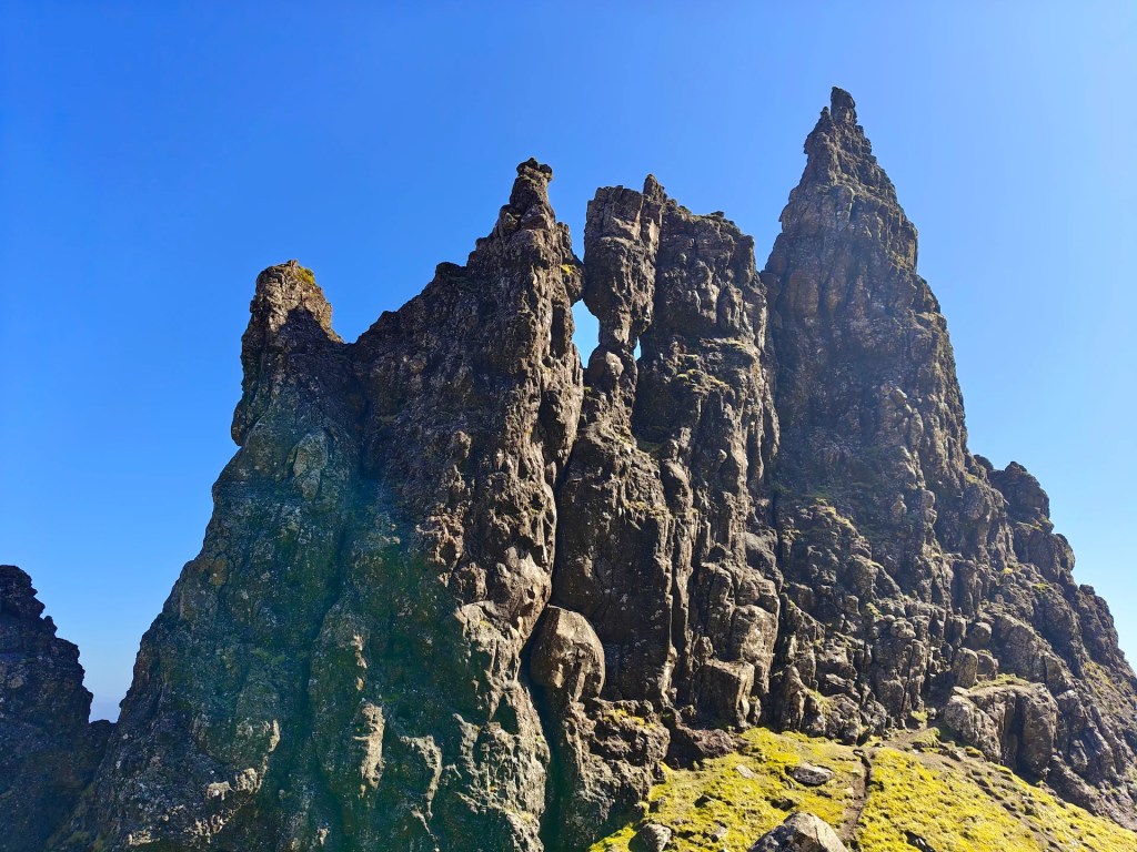
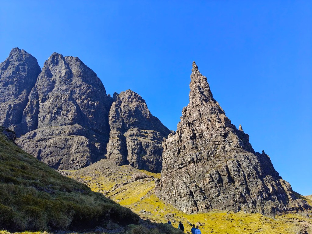
The Old Man of Storr is one of the most iconic and frequently visited landmarks on the Isle of Skye, seeing in excess of 220,000 visitors each year, renowned for its towering cliff faces and striking rock pinnacles, most notably the Old Man of Storr itself (Bodach an Stòir in Gaelic) and the adjacent Needle.
According to local folklore, the Old Man of Storr was once a giant who, upon his death, was buried in the earth. Legend says that the prominent pinnacle we see today is his thumb, left protruding from the ground. However, some locals, with characteristic Hebridean humour cheekily suggest that the rock formation resembles something rather less innocent, claiming that the name might be more accurately translated as the “Penis of Storr.”
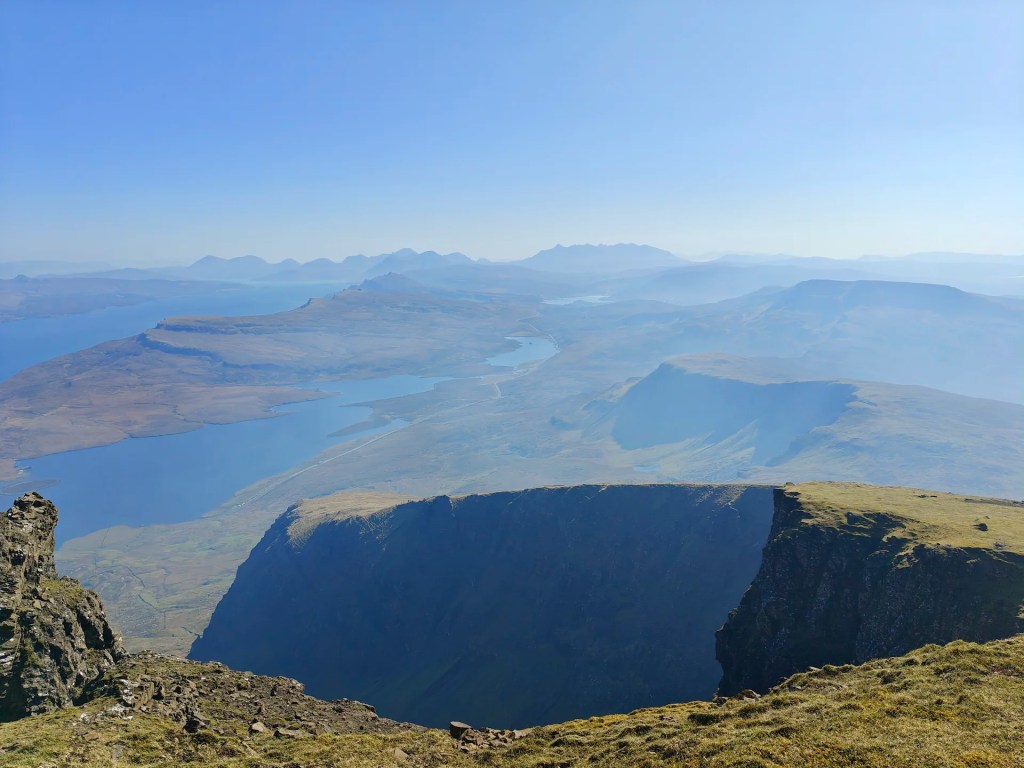
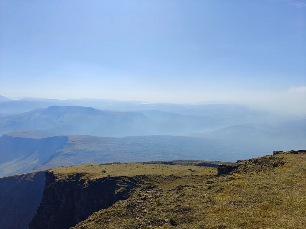
Geologically, The Storr forms part of the Trotternish Landslip, more widely known as the Trotternish Ridge. The largest landslip of its kind in Great Britain. The area directly below the towering cliffs is commonly referred to as The Sanctuary, a name likely of more recent origin. It describes the natural amphitheatre-like hollow created by ancient rockfalls and landslides, lending the landscape both drama and a sense of seclusion.
Gallery


The Walk
This is one of if not the most rewarding walks on Skye and is not to be missed if travelling to Skye for only a short amount of time.
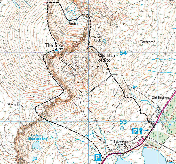
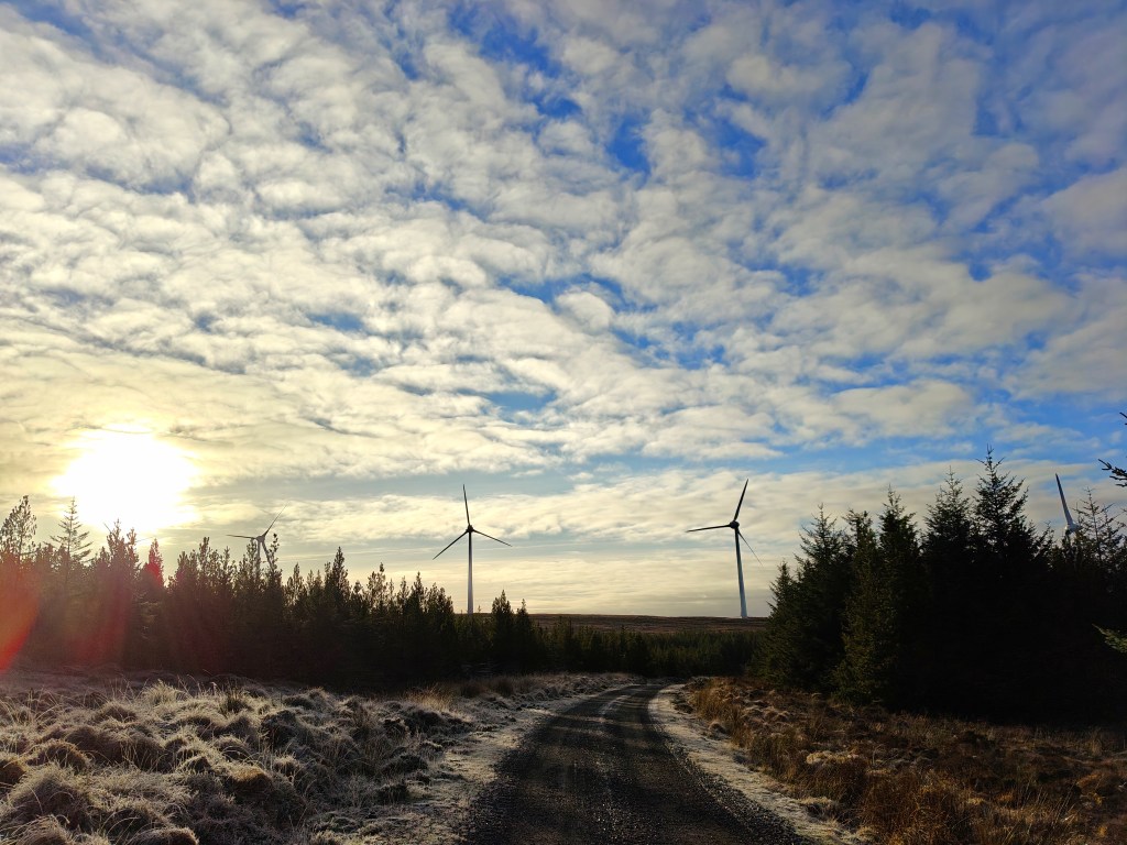
Start by parking at the large car park below the Storr. Don’t forget to purchase a parking ticket. From there, head to the clearly signposted start of the trail.
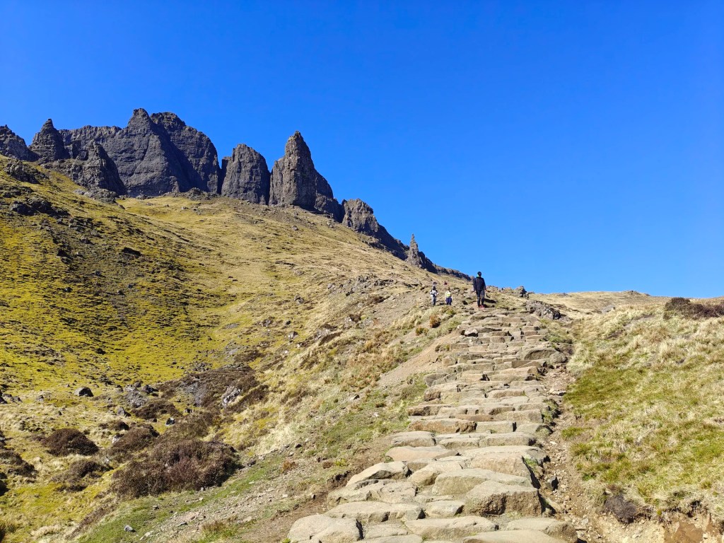
Pass through the gate and follow the well-maintained path as it gently climbs the lower slopes of the Old Man of Storr. Along the way, you’ll pass several breathtaking viewpoints and ascend a broad flight of stone steps leading to the base of the Needle Rock, a striking pinnacle renowned worldwide for its beauty.
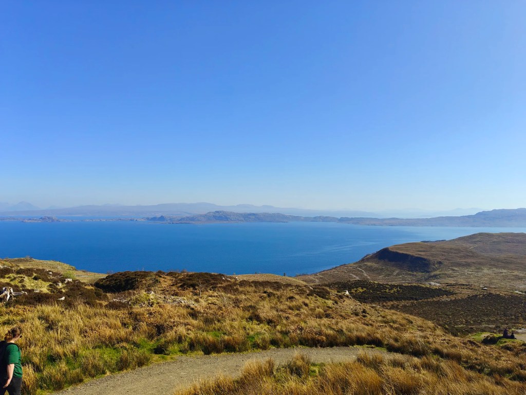
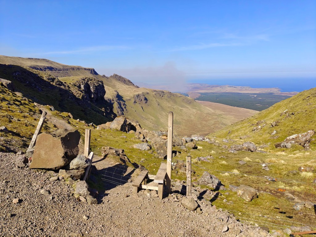
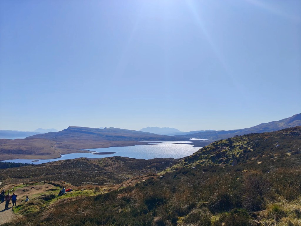
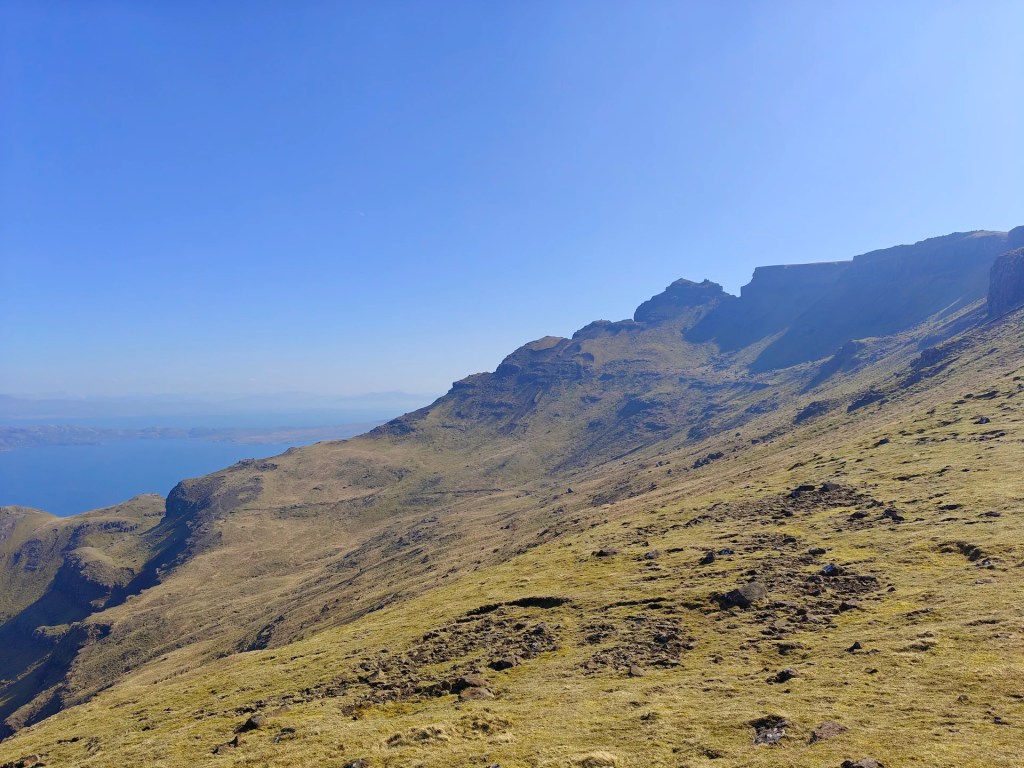
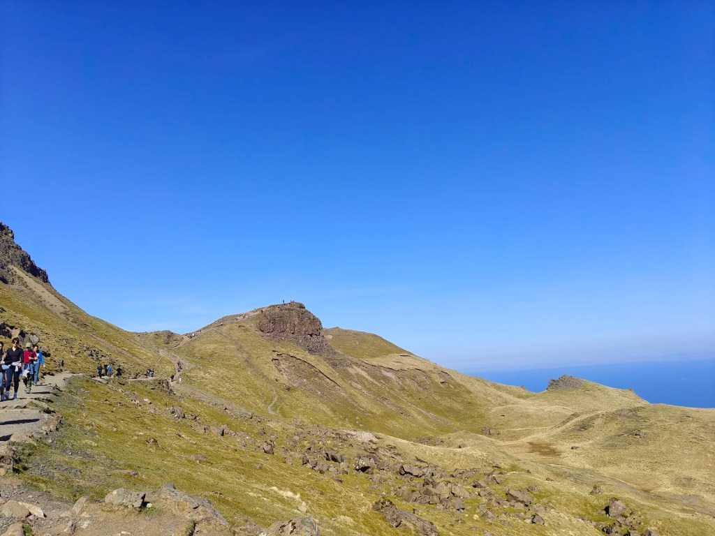
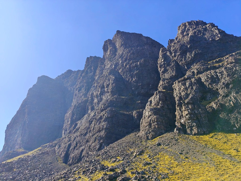
Continue along the path as it winds north towards the viewpoint summit. It’s worth making the short additional climb to enjoy the spectacular views from the top. After visiting the viewpoint, retrace your steps slightly downhill and continue northwards. You’ll soon reach a stile over a fence, cross it. From here, the trail veers left. This section involves some light scrambling, take your time, choose your route thoughtfully, and exercise caution as this area can be quite dangerous, especially in poor conditions.
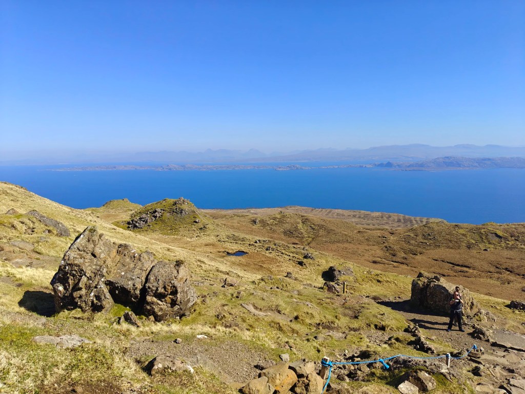
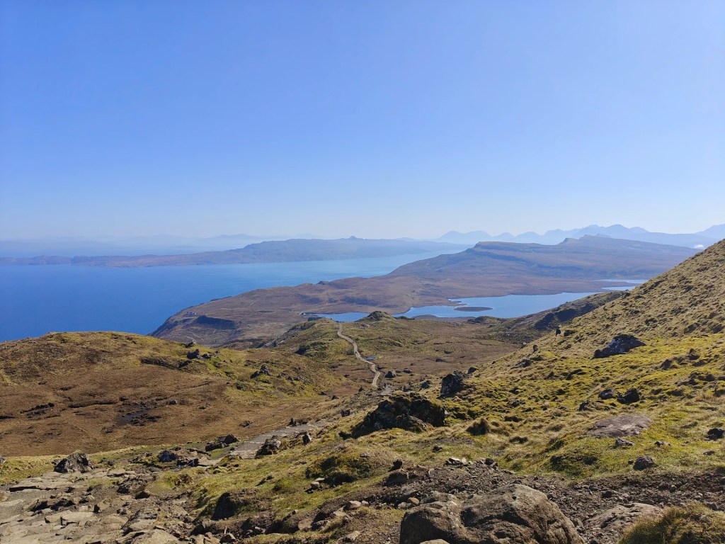
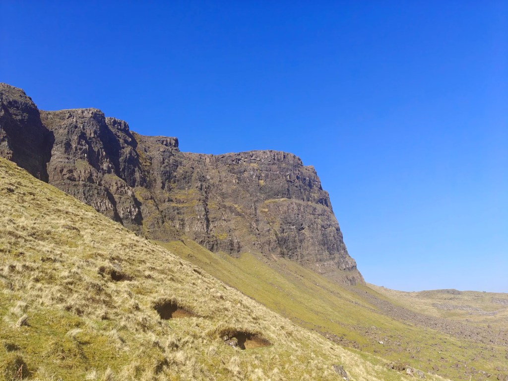
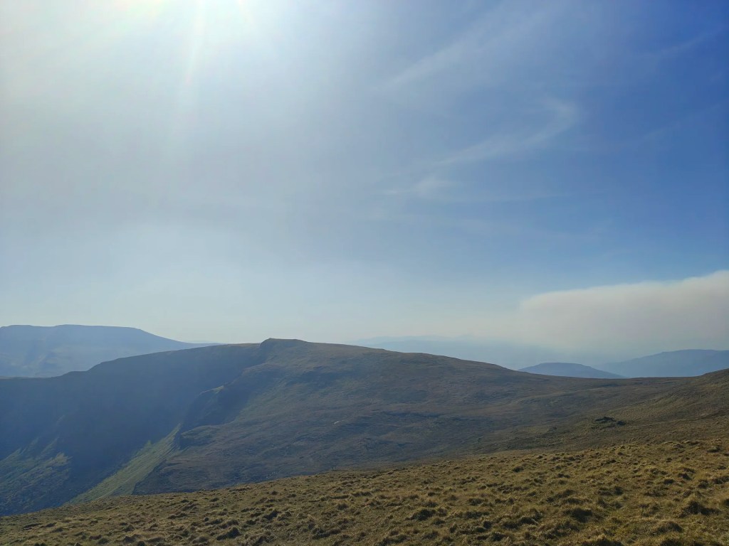
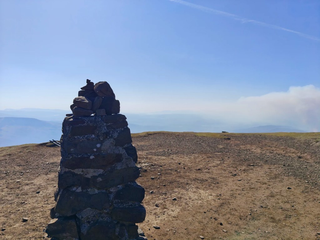
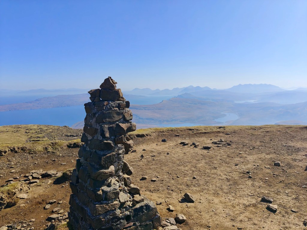
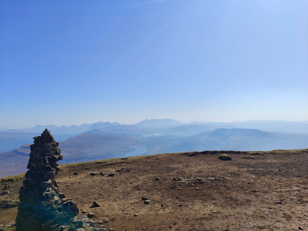
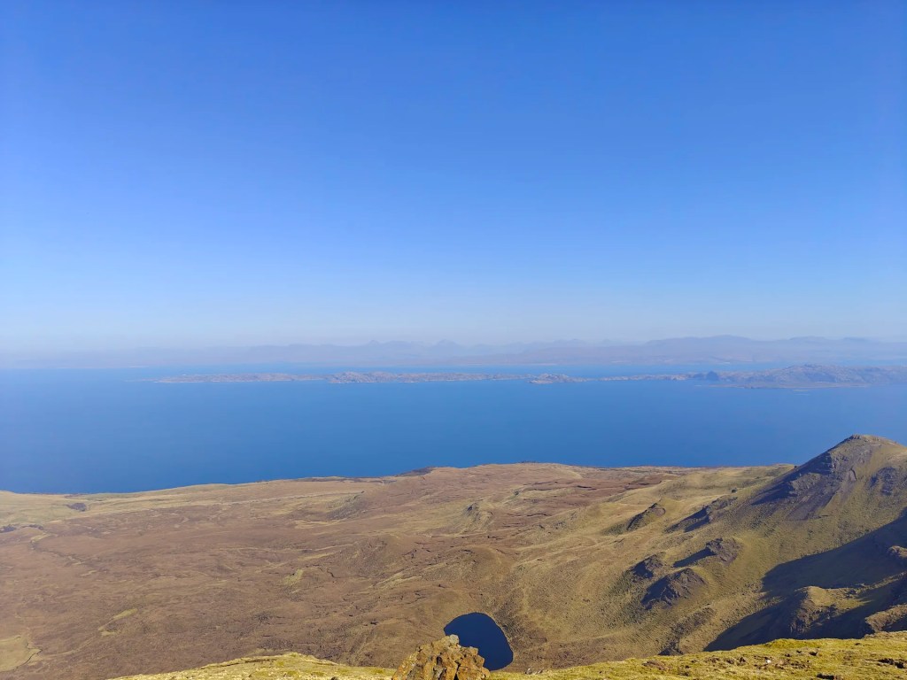
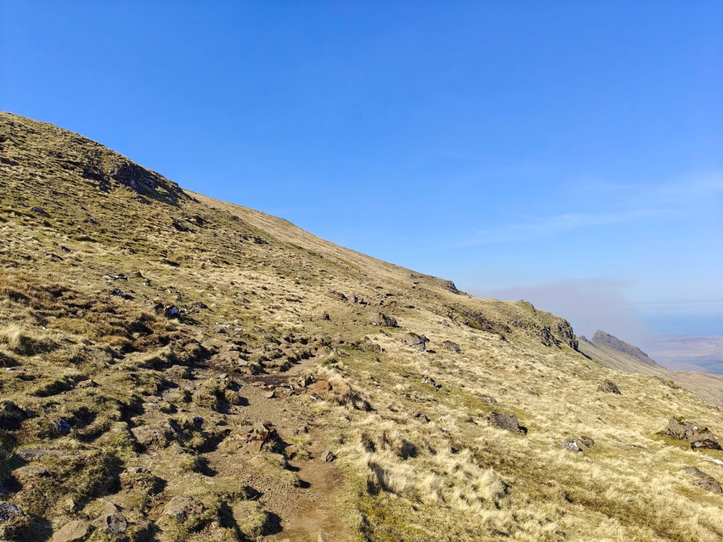
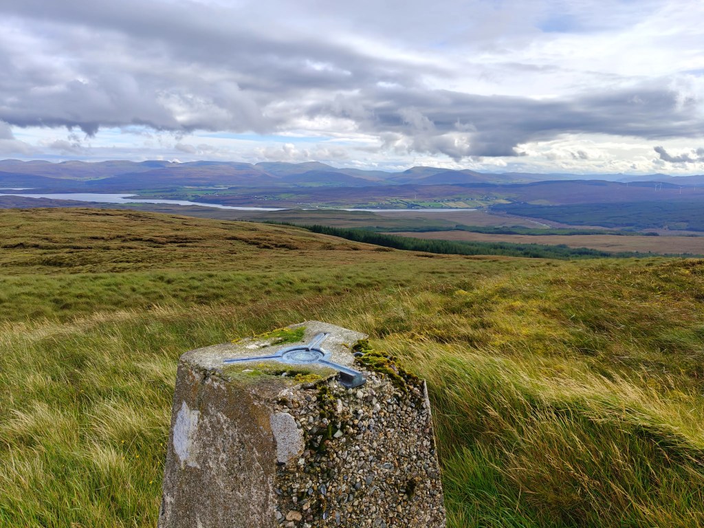
Follow the obvious trail, which forms part of the Trotternish Ridge Walk, as it curves steadily northward. Eventually, you’ll arrive in the Coire Scamadal area at an elevation of approximately 550 metres, where the hillside opens to your left. Here, leave the main trail and head west up the hill for a short distance, then turn south along the ridgeline. You’ll cross rough, rocky terrain before reaching the summit of The Storr, marked by the Trig Point at 719 metres.
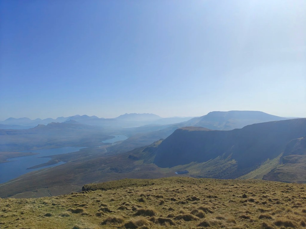
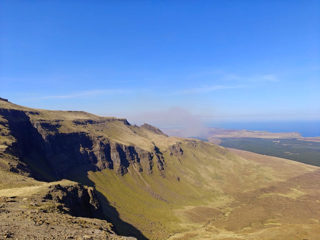
From the summit, you have two options, you can either return via the same route, or for a more scenic descent, continue south along the dramatic ridgelines. The route drops steeply above towering cliffs, so stay alert.
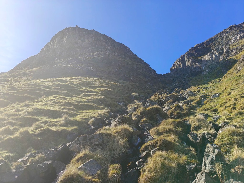
Follow faint tracks southward over grassy slopes and occasional boggy patches, keeping a safe distance from the cliff edges. Aim for Bealach Beag (meaning ‘Small Pass’ in Gaelic), a shallow pass marked by a narrow stream. Follow the path along the north side of the stream as it descends rapidly through the gully. Be mindful that the rocks here can be slippery.
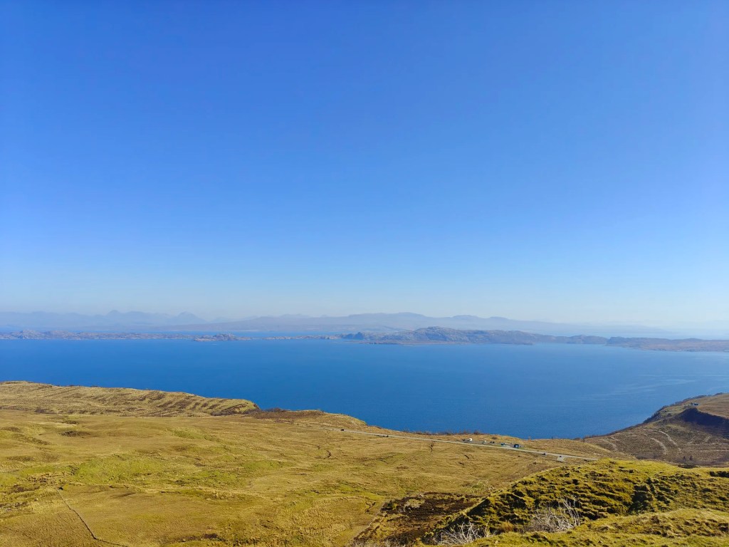
At the bottom of the gully, follow any faint trails or navigate cross-country towards the main road to the southeast. Once you reach the road, turn east and follow it back to the car park where you began.


Leave a comment