| Altitude | 1354 Feet |
| Trail Conditions | Well-established foot trails |
| Difficulty | Low |
| Experience | 10/10 |
| Est. Time | 2-4 hours |
| Distance | 4-5 Miles |
| Starting Location | Tianavaig Bay Car Park – Camustianavaig |
History of the Local Area
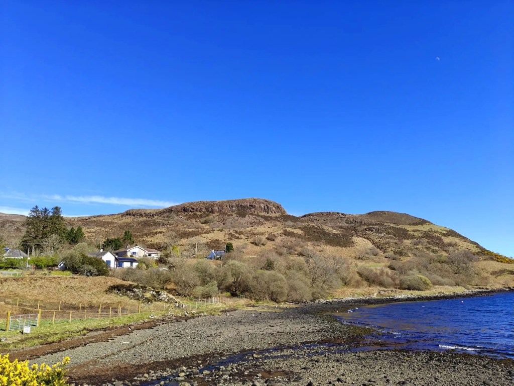
Camustianavaig is a small crofting township located at the start of this walk. Its original name, “Camas Dionabhaig,” derives from both Gaelic and Norse roots. In Gaelic, “Camas” means “bay,” while the Norse “dyn” translates to “noisy.”
The township is most famous for being the site of the Battle of the Braes in 1882. At the time, local crofting tenants, facing eviction from their long-held homes, withheld rent and allowed sheep to graze on a restricted area along the shores of Ben Lee. In response, a local sheriff was sent to enforce the evictions but was confronted by an angry mob who forced him to burn the eviction notice. Following this failed attempt, 50 Glasgow policemen were dispatched to quell what had now become a full-scale rebellion. However, they were met by over 100 men, women, and children from the area, armed with sticks and stones.
After the initial skirmishes, the rebellion spread to Glendale, where another significant battle took place between the locals and the government forces.
This widespread unrest, fueled by the courage of the local men and women, led to the establishment of the Napier Commission. This public inquiry examined the conditions of the crofters and cottars of the Highlands and Islands and ultimately contributed to the Crofters Act of 1886, which granted crofters security of tenure and the right to pass their crofts on to their heirs.
The events also inspired several local poems and songs, the most famous of which is “The Battle of the Braes,” which commemorates the local fight for justice.
Oh, if we send one million men’
In London they declared,
‘We’ll never clear the Isle of Skye.
The people are not scared.’”
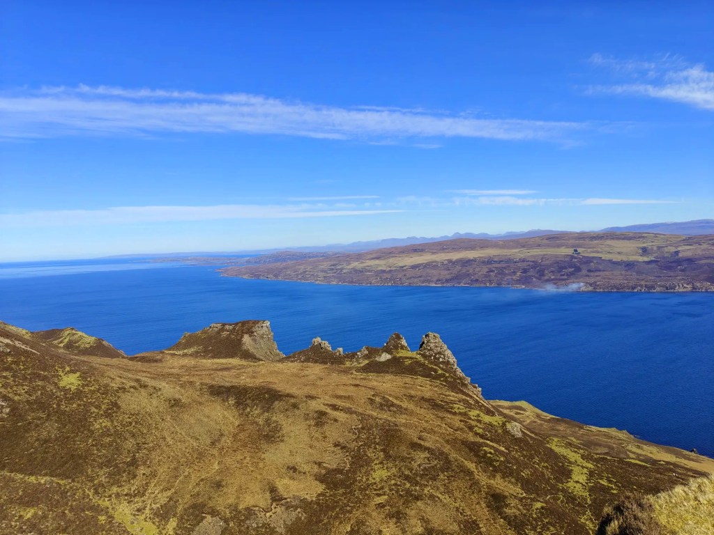
Macqueen’s Rock, located along the ridgeline of Ben Tianavaig, and Macqueen’s Loch to the north-east likely derives their names from the Macqueen clan, who have historical ties to the island. However, despite research, I’ve been unable to find any specific reference explaining the exact reason for this name. It’s possible that the origin of the name is based on a local tale or has simply been lost to history.
Gallery


The Walk
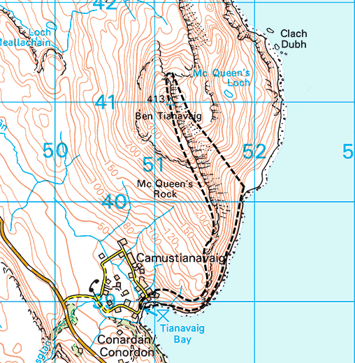
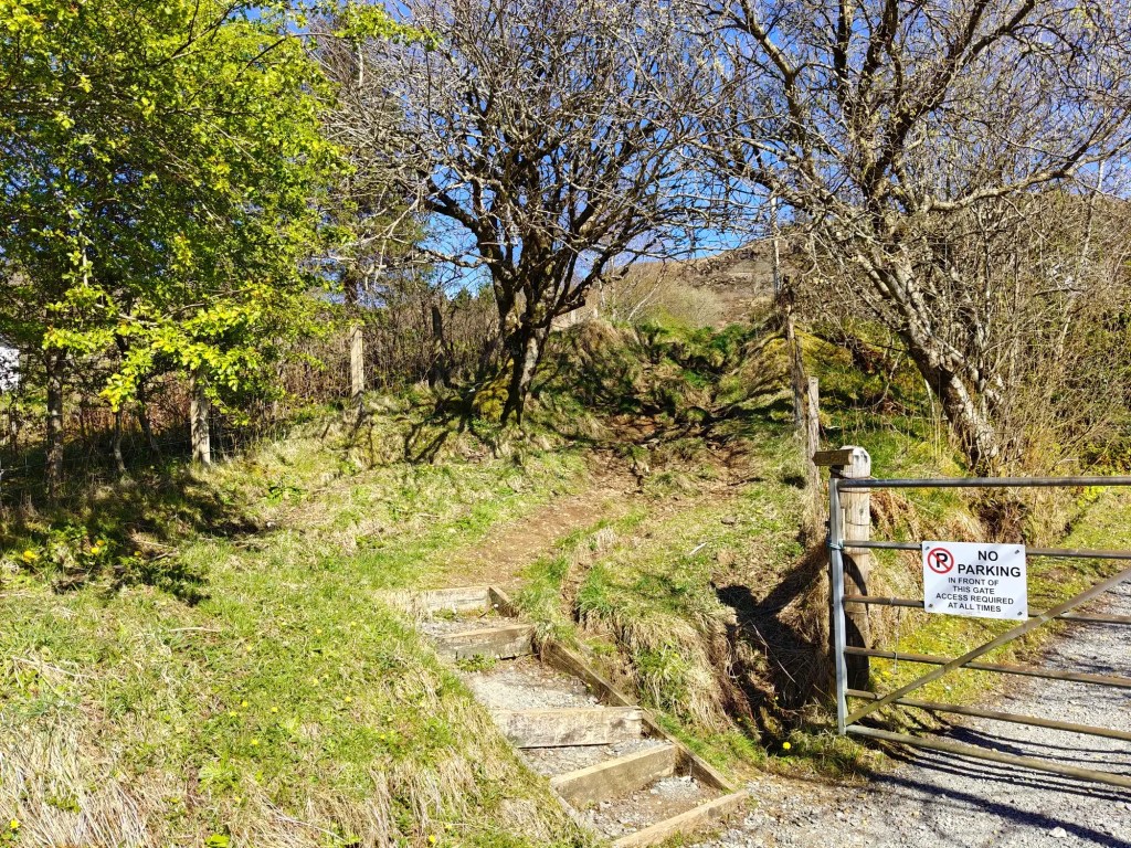
This rewarding walk begins at the Tianavaig Bay car park, a long layby-style parking area nestled right beside the beach. From here, head north up the road until it bends to the left. At this corner, leave the road via the right-hand side, where a well-trodden path climbs between gardens – look out for a small set of steps marking the start of the trail.
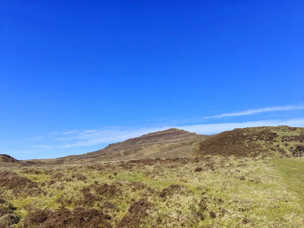
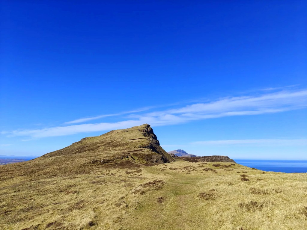
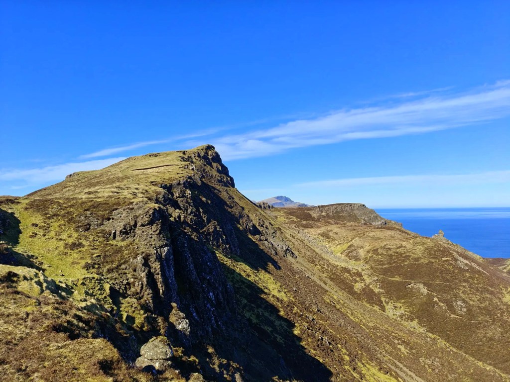
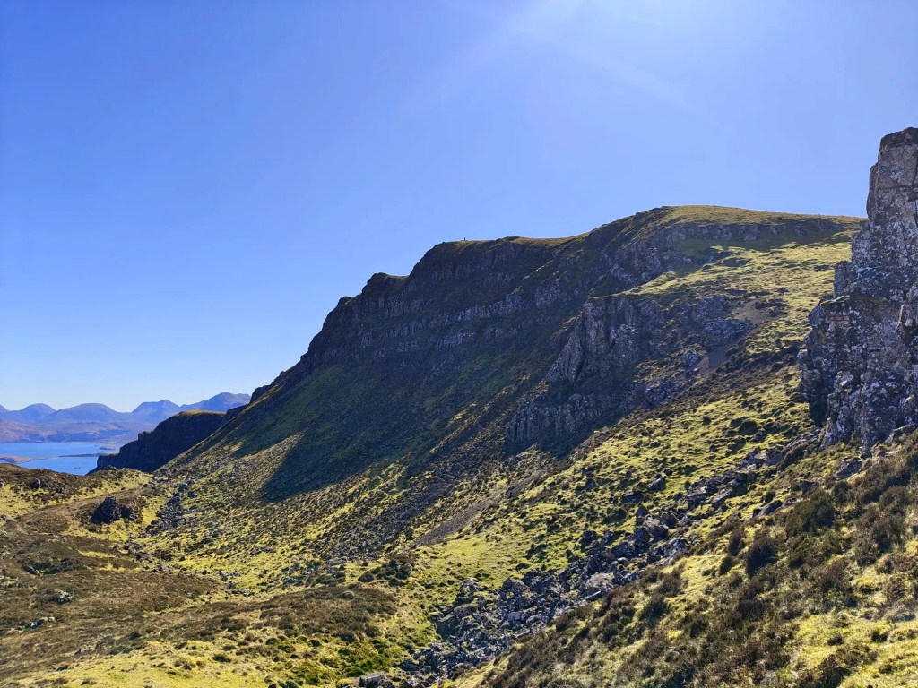
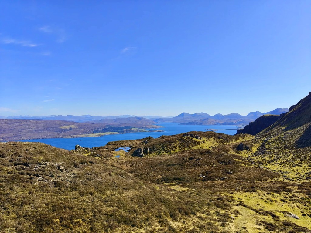
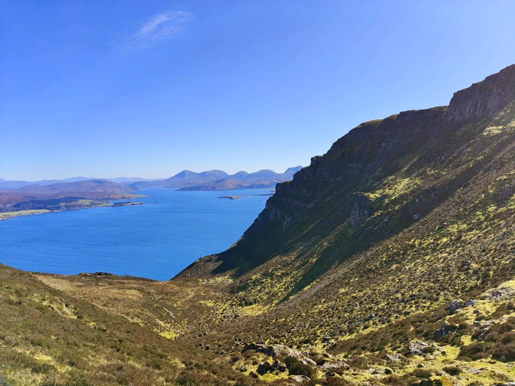
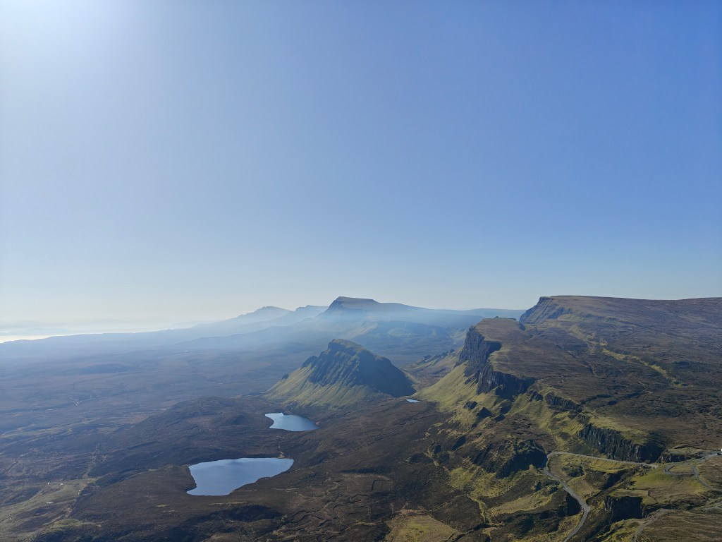
The path gently winds its way up the rocky slope of Creagan na Sgalain (which loosely translates from Gaelic as “Rocks of Sgalain”), gradually gaining elevation. The trail then veers north, joining one of several established footpaths that trace the length of McQueen’s Rock, a striking ridgeline running above the coast.
From here, you can choose to walk right along the ridge edge, where you’ll enjoy breathtaking views over the sheer eastern cliffs of Ben Tianavaig, or opt for one of the slightly more sheltered inland routes—a safer option in windy weather or if you’re hiking with family or pets. On a clear day, the western side of the ridge becomes a sun trap, often warmed by the afternoon light with occasional cooling breezes—so don’t forget to bring extra water.
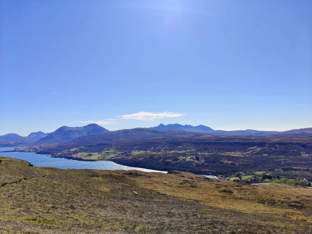
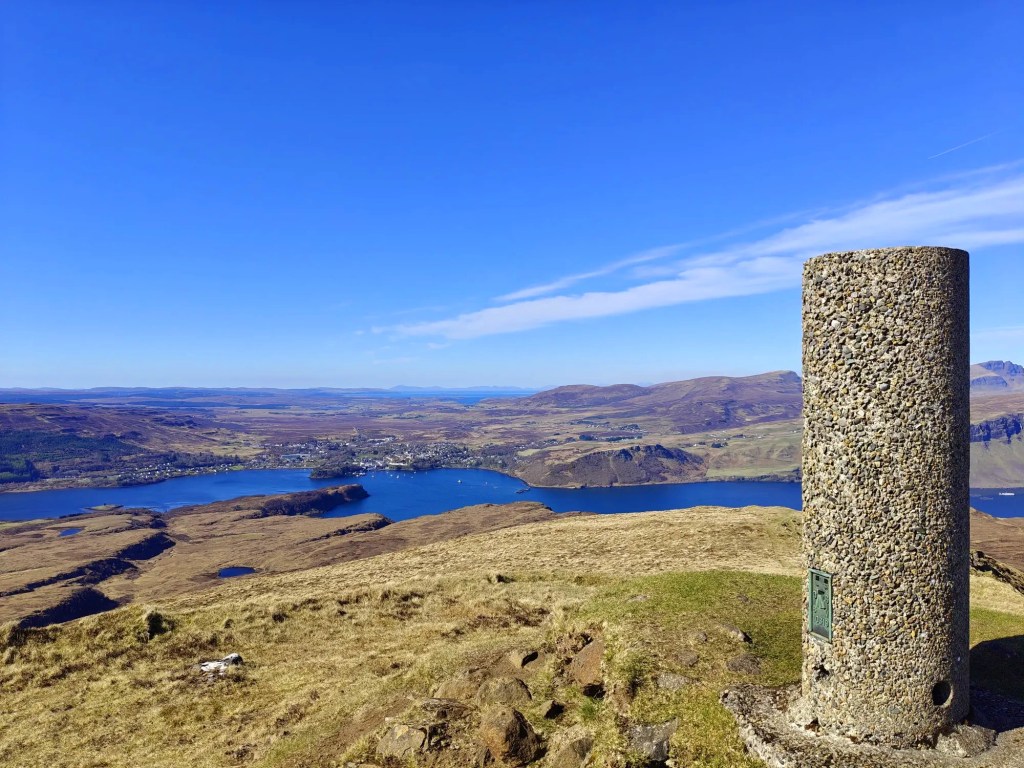
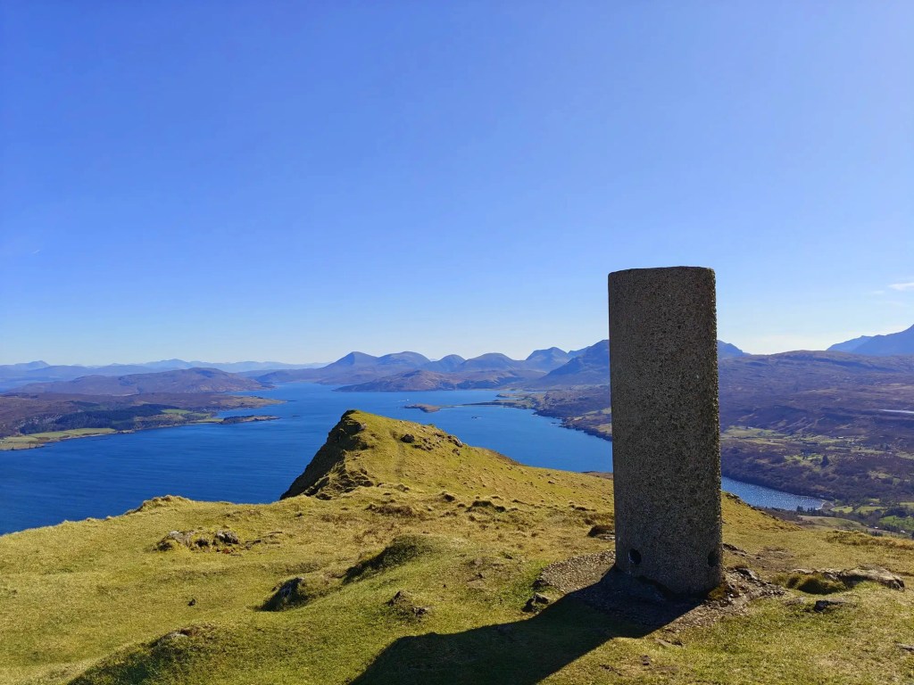
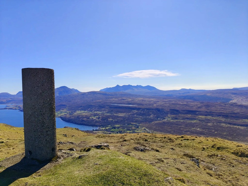
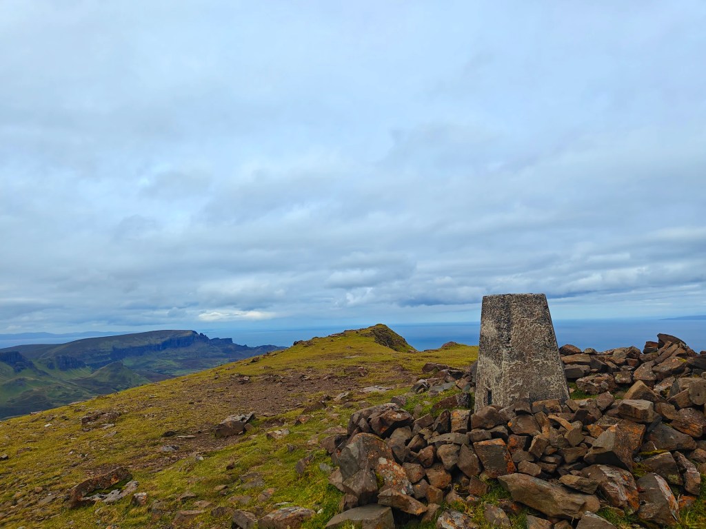
The climb continues for about 1.5 miles, steadily rising from just 4 metres above sea level at the start to 413 metres at the summit trig point of Ben Tianavaig. Along the way, you’ll pass a few false summits, but the reward is worth it—panoramic views stretch over Portree to the northwest, the Isle of Raasay to the east, and the distant peaks of the Cuillins to the south.
After soaking in the scenery and taking a well-earned break at the summit, you have two options: retrace your steps back down the ridge, or, as I’d recommend, continue the loop northwards.
As the ridge descends, it curves to the east—follow the narrow sheep tracks down into the valley known as An Ceam Dubh. (This name likely comes from An Ceann Dubh, meaning “The Black Headland” in Gaelic—“Ceam” may be a transcription error on some maps.)
Descend past a path of fallen stones at the valley’s lowest point, keeping roughly parallel to the towering cliffs of Ben Tianavaig on your right. The route now threads through several rocky dips and grassy hollows, with sheep paths weaving between large boulder fields. As you approach the bottom, you’ll spot a broad grassy flat bordered by the beach—take care here, as there are some steep drops. If the descent looks too tricky, look for a gentler path off to one side.
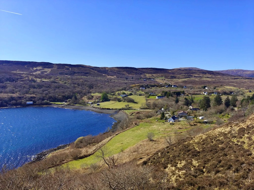
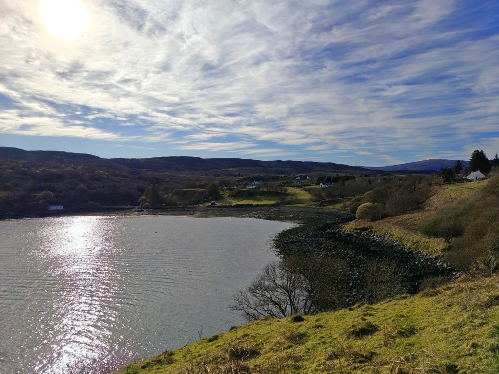
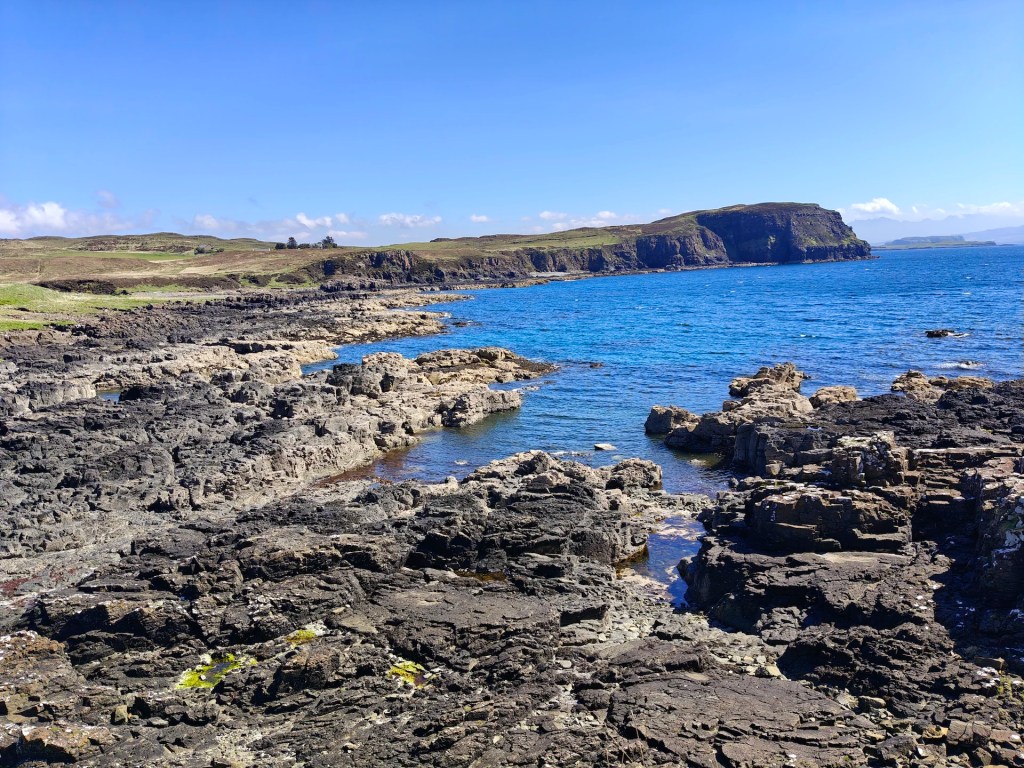
Once you reach the beach, follow the coastal trail south, hugging the shoreline back toward Tianavaig Bay. Eventually, you’ll pass through a wooden gate giving access to the beach near Camustianavaig.
Cross the beach’s rocky stretch, and just before the stream flowing into the bay, turn right and follow the path back up to the road, returning you close to your starting point


Leave a comment