| Altitude | 1781 Feet |
| Trail Conditions | Well-established foot trails |
| Difficulty | Medium |
| Experience | 10/10 |
| Est. Time | 2-4 hours |
| Distance | 4-5 Miles |
| Starting Location | Quiraing Car Park |
History of the Local Area
The incredible, otherworldly landscape of the Quiraing, which you traverse on this walk, is not the result of ancient glaciers but is the living monument to a more dramatic geological process: the largest landslip in Great Britain.
The entire eastern face of Meall na Suiramach, and the broader Trotternish Ridge, was formed when heavy layers of ancient basalt lava slid seawards over much weaker underlying sedimentary rock. Remarkably, this massive landslip is still active, moving a few centimetres each year, a slow-motion spectacle of Earth’s power that requires constant repairs to the road below.
The name itself provides a direct link to the area’s human history. Quiraing is derived from the Old Norse term ‘Kví Rand’, which translates roughly to ‘Round Fold’.
During the time of the Norse (Viking) presence on the Isle of Skye, local inhabitants are said to have used this natural, high-walled enclosure to conceal their livestock. The central, flat plateau known today as “The Table” was the perfect hiding place, protecting cattle from Viking raiding parties who rampaged along the coast.
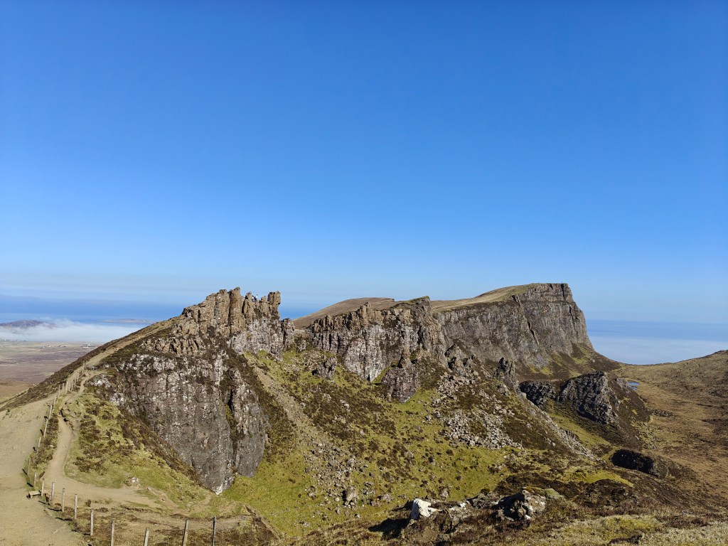
This deep fold in the earth also features distinct rock formations that have captured the imagination for centuries, giving them their memorable names.
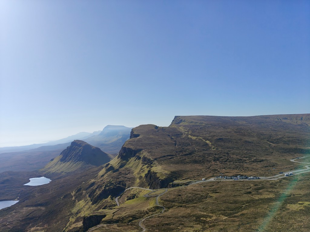
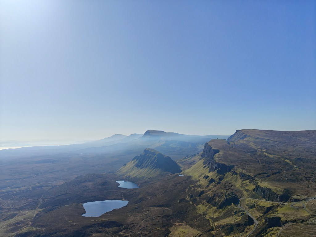
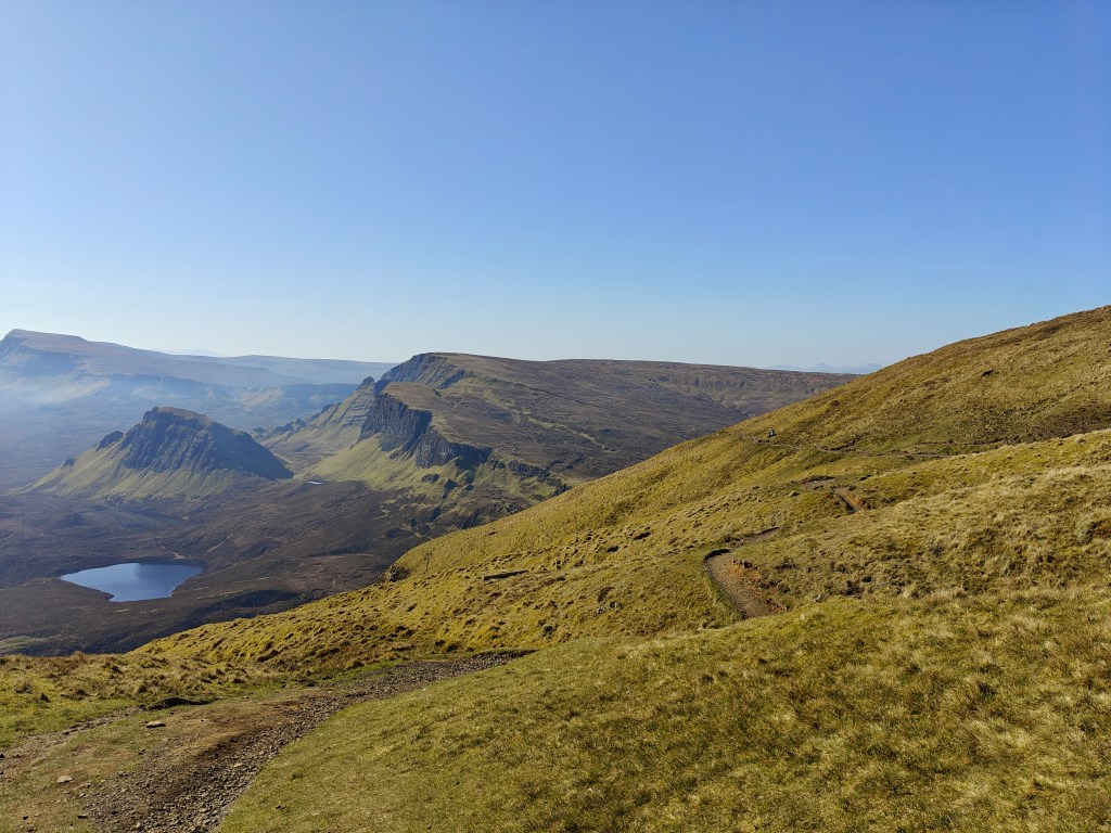
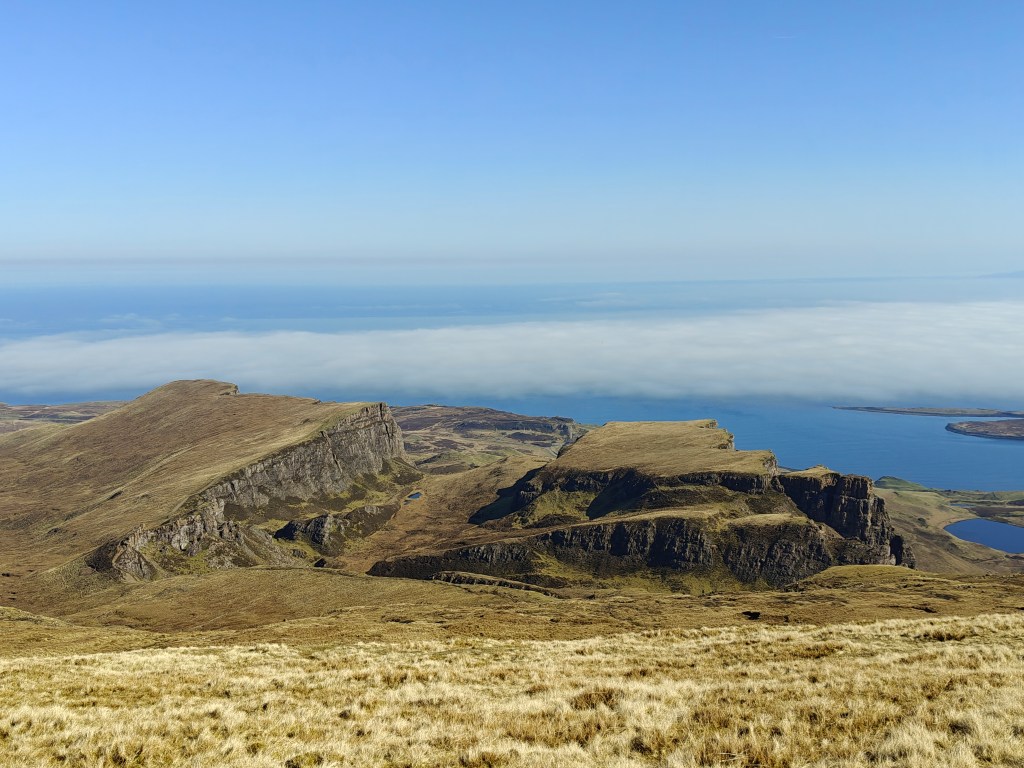
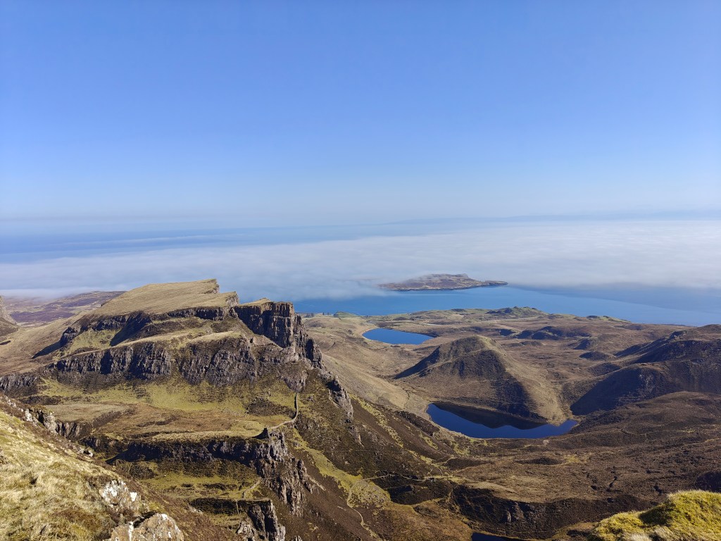
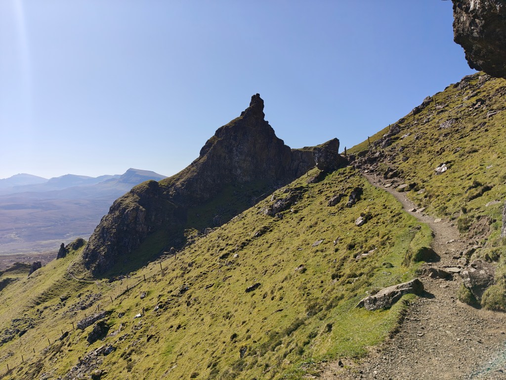
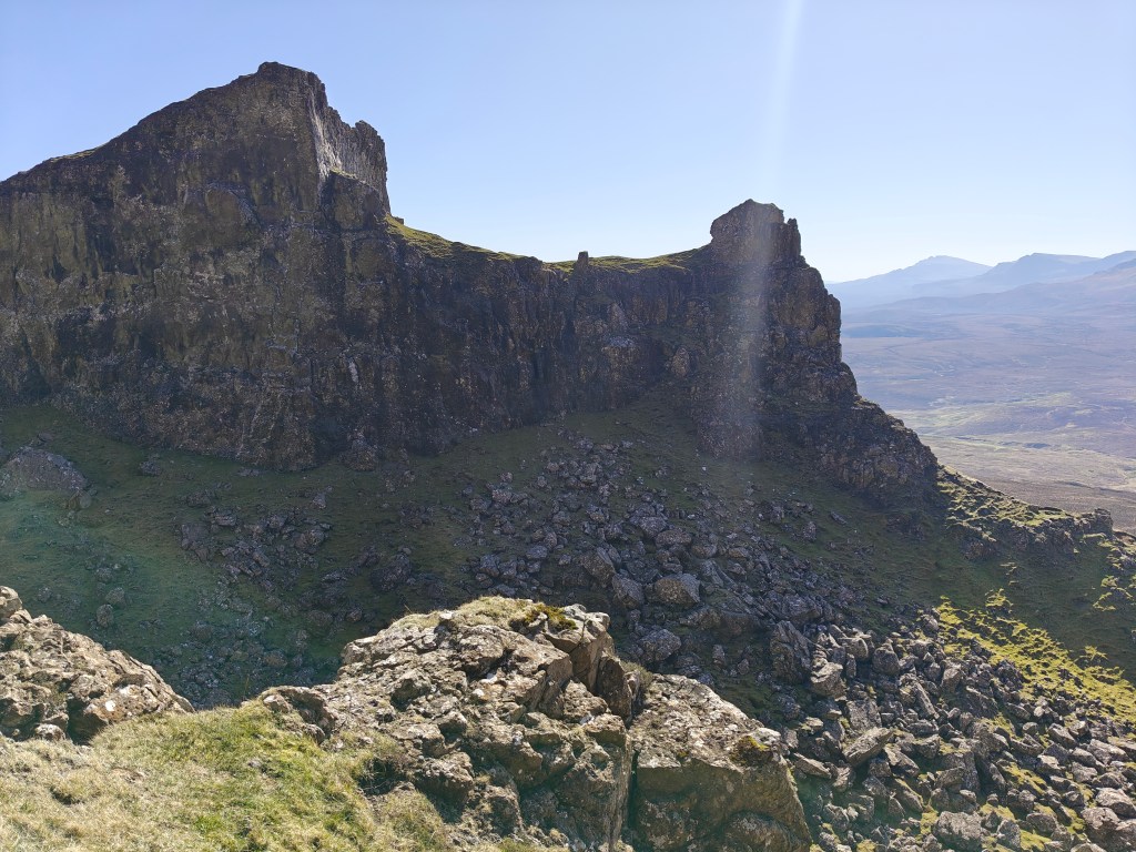
As you walk above them, you look down on “The Needle” – A jagged, 120-foot high pinnacle; “The Prison” – A towering mass of rock said to resemble a medieval keep, and “The Table” – The flat, grassy summit where cattle were once hidden, and which is even reputed to have hosted games of shinty in more recent history.
The sheer, fantastic appearance of this landscape has long been noted, with the Scottish poet Alexander Smith describing it in 1865 as “a nightmare of nature.” Walking this trail is to step through a place where geology, history, and folklore are profoundly intertwined.
Gallery
The Walk
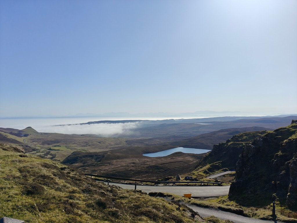
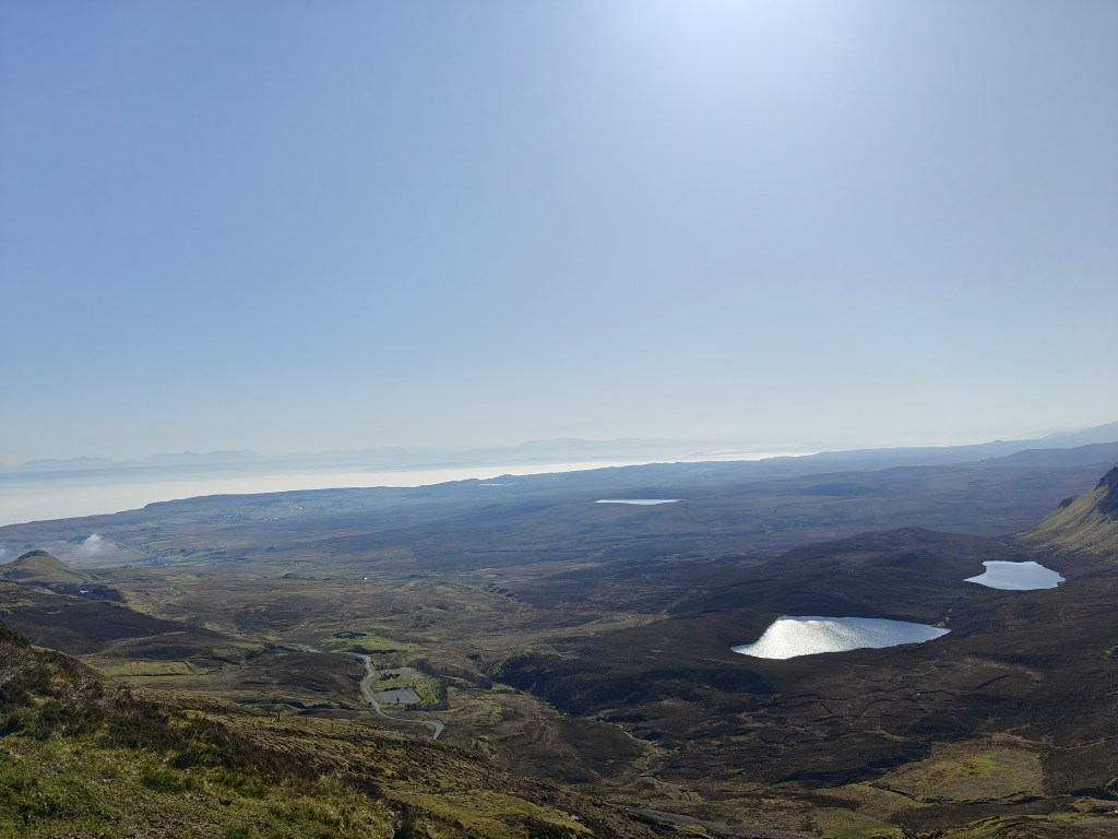
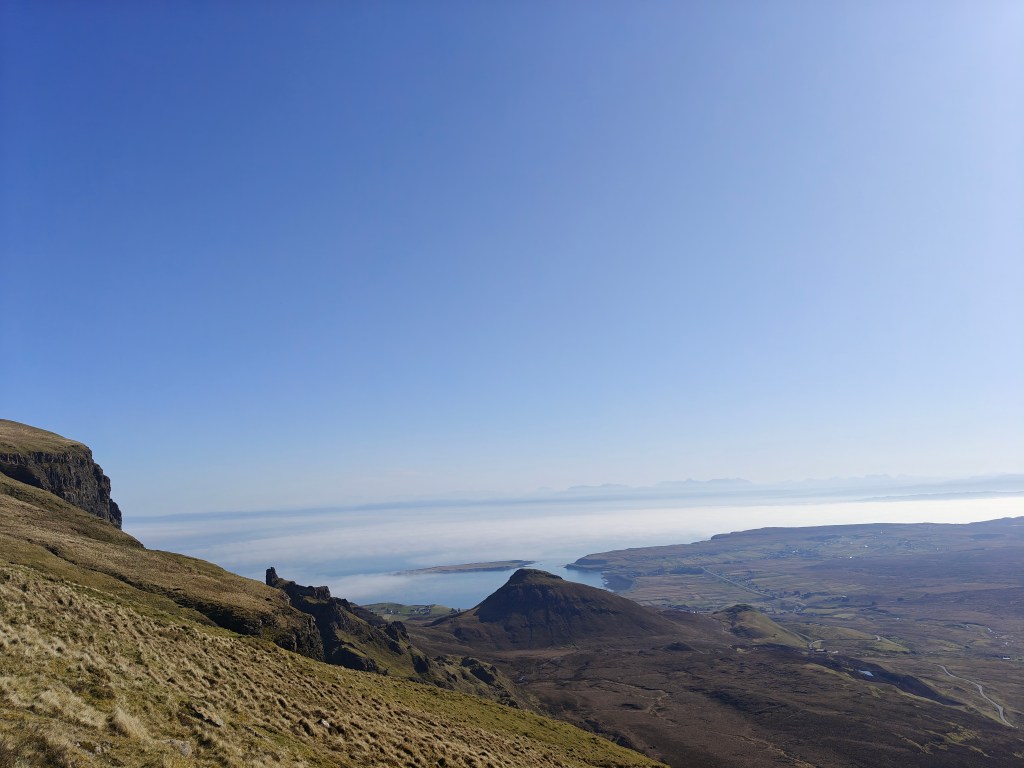
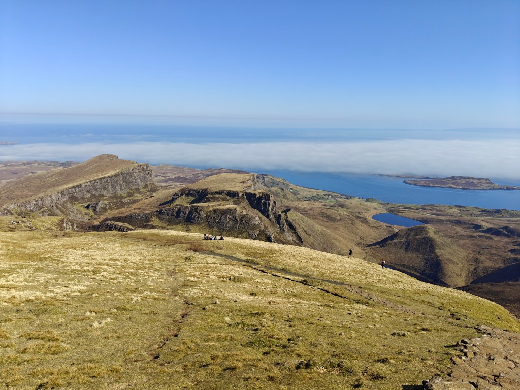
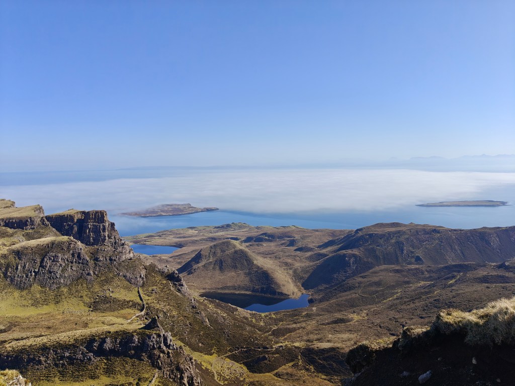
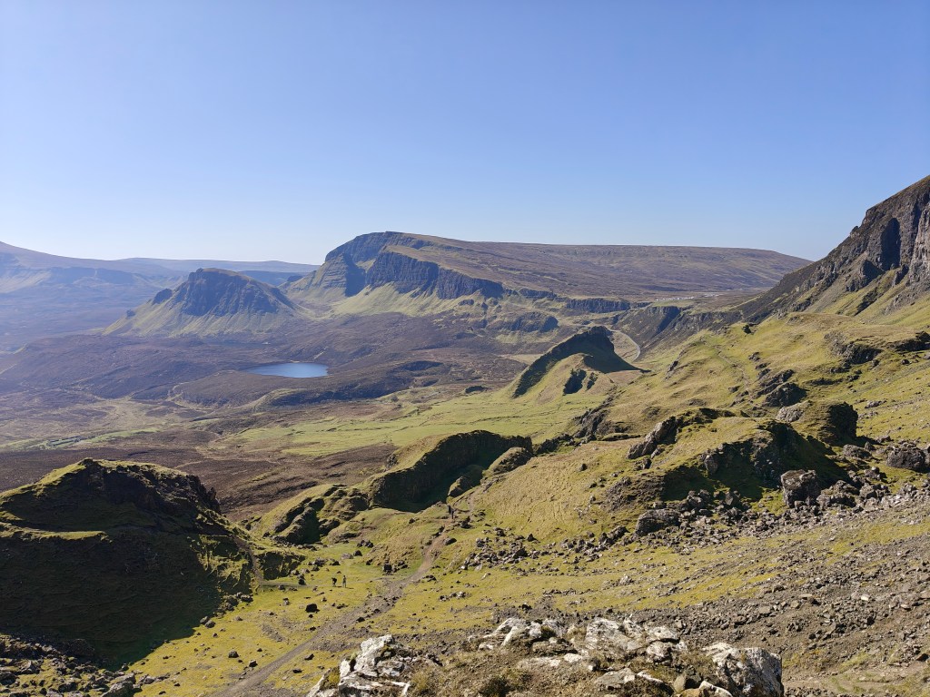
This route circles the spectacular landslip of the Quiraing, offering panoramic views across the Trotternish peninsula.
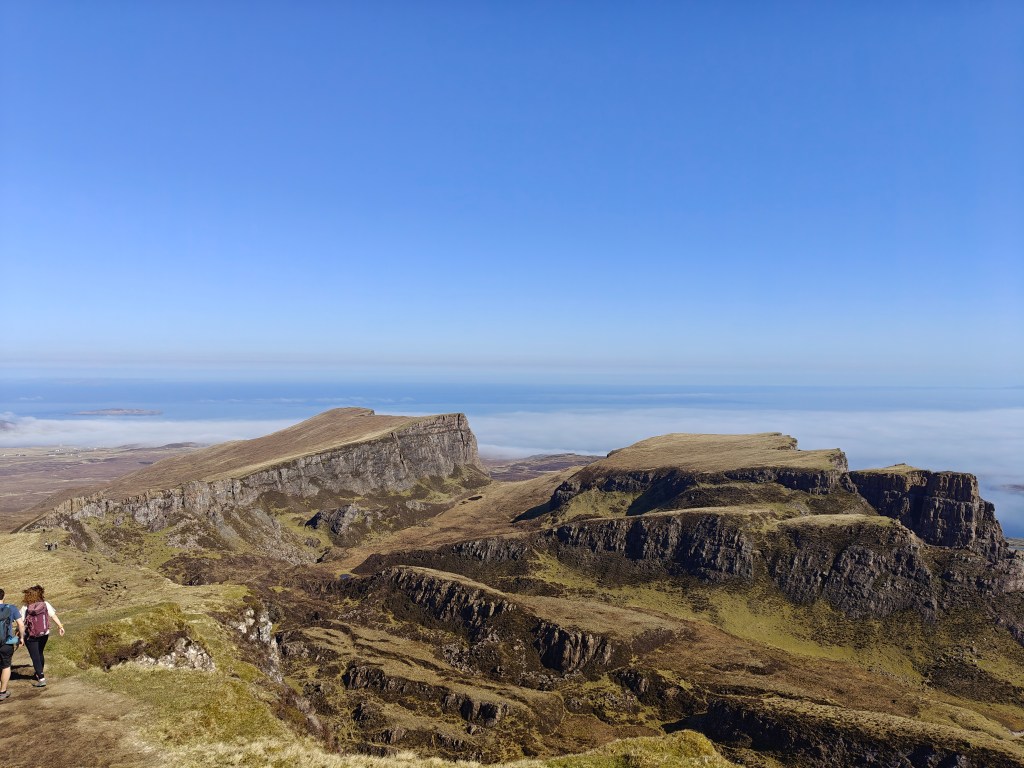
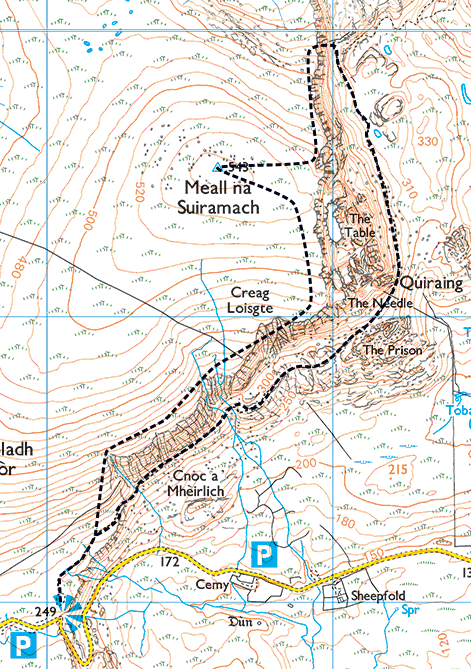
The walk begins at the Quiraing Car Park (remember to purchase a ticket). Before setting off, take a moment to absorb the breathtaking views to the east from the clifftop right above the car park. Although many guides recommend completing this circuit anti-clockwise, I suggest walking it clockwise. This way, you enjoy the spectacular summit views sooner and save the most dramatic section—the cliffside path—for the grand finale as you descend.
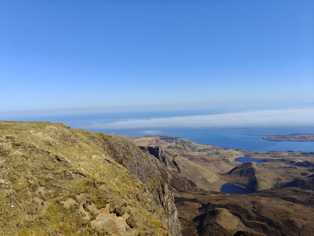
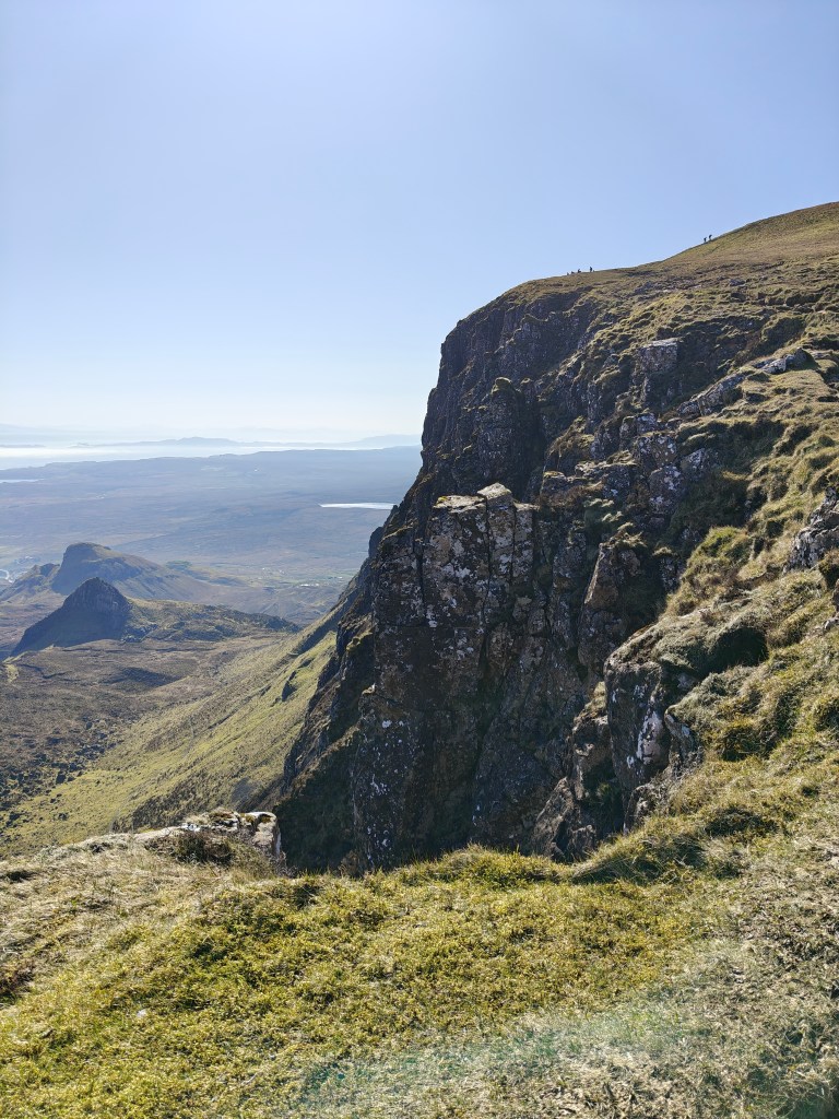
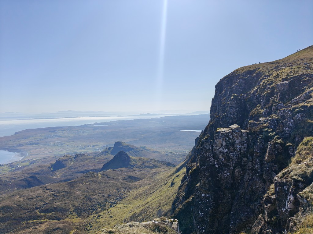
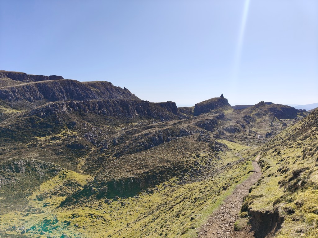
To begin the clockwise loop, follow the well-defined trail as it winds up the hill to the north-east until you reach a gate. Proceed through this gate and continue across the wide-open field, following the clear foot trails as you steadily climb towards the higher ground of Meall na Suiramach. Eventually, the towering cliff face will start to curve around to the north in front of you, placing you above the famed pinnacle marked on OS Maps as “The Needle.”
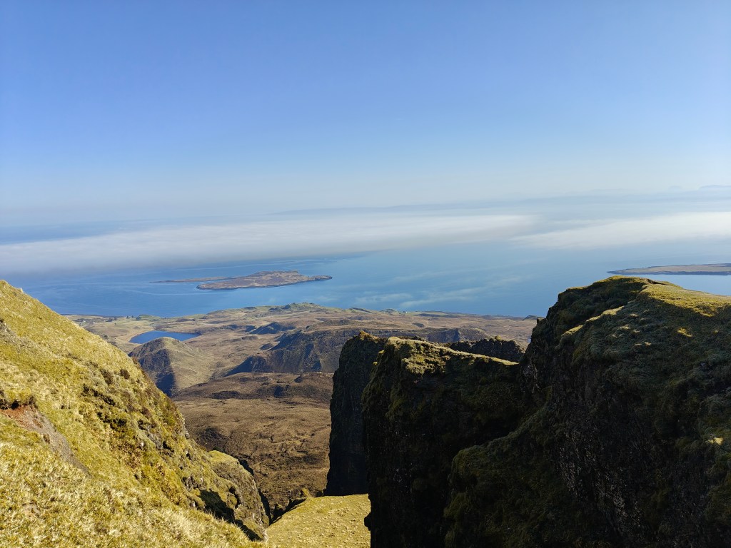
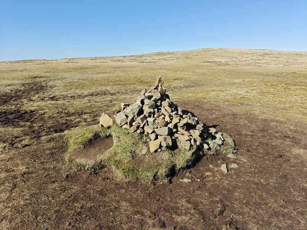
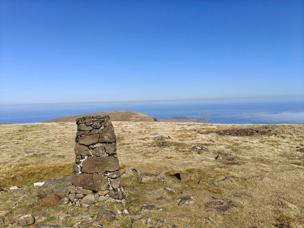
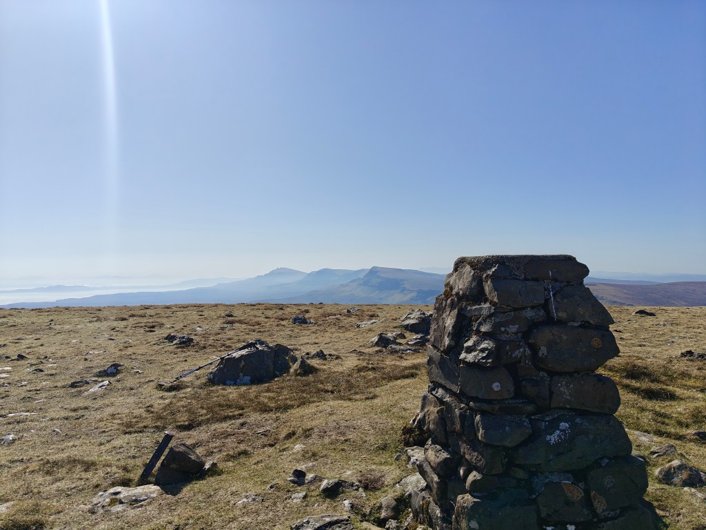
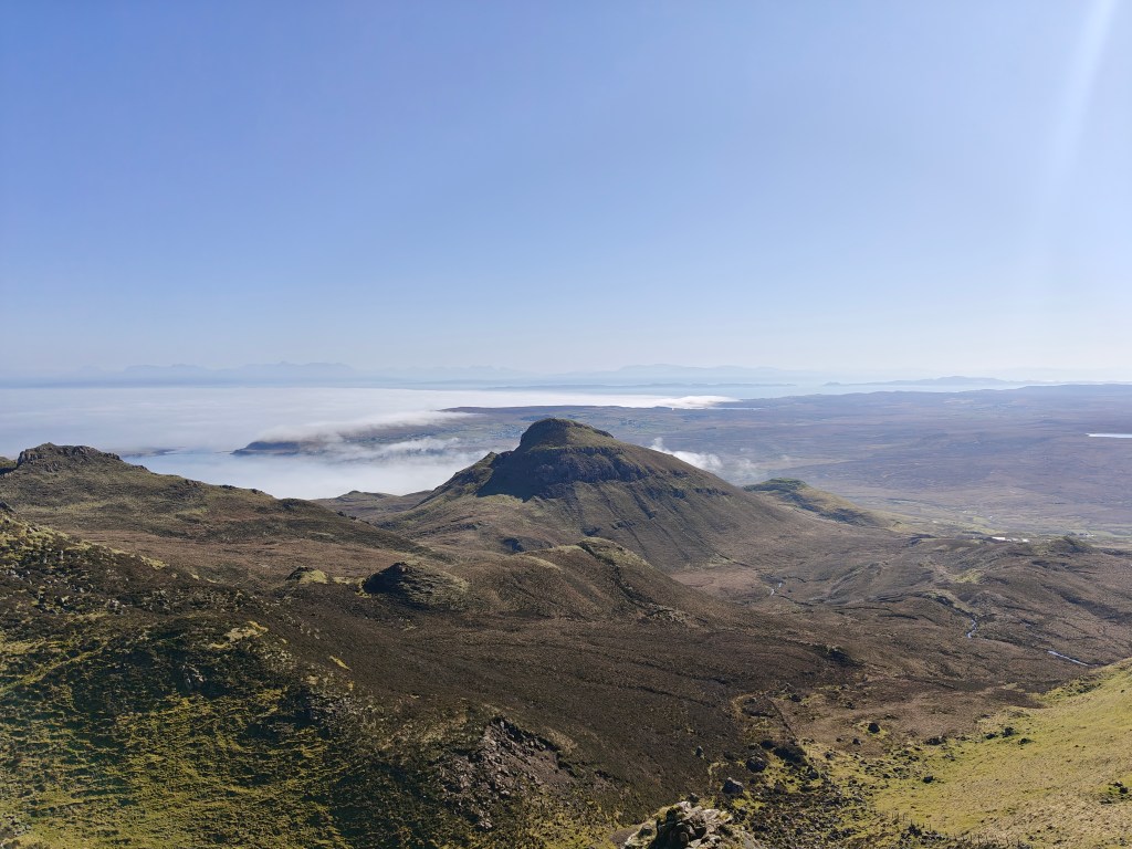
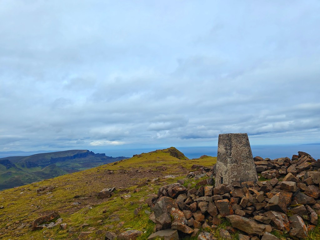
Continue tracking north. You will soon locate a pile of stones placed by previous walkers. Please avoid adding to this structure, as the practice of building cairns off-trail is a significant contributor to erosion in this fragile landscape. From here, head north-west to reach the Trig Point, which sits proudly on a slightly raised mound on the large, exposed plateau. Once you’ve captured the panoramic views of the surrounding coast and peaks, it is time to head east and rejoin the main walking trail.
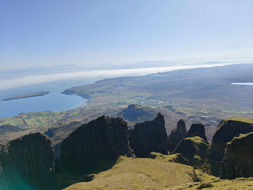
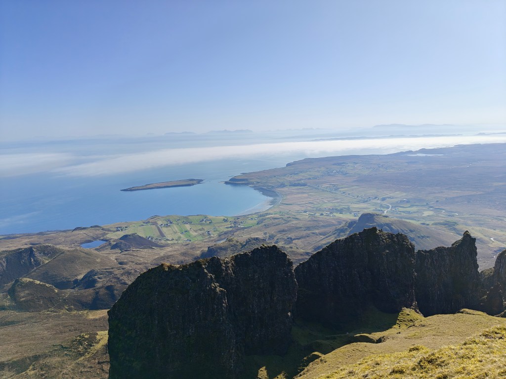
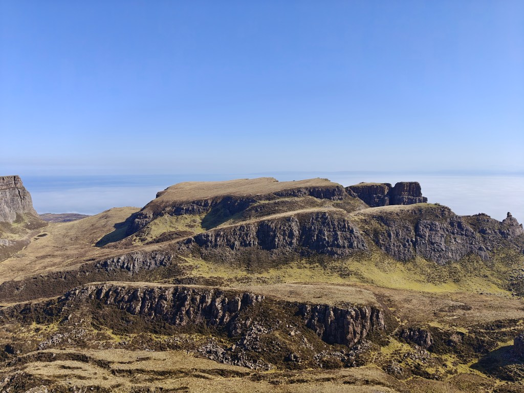
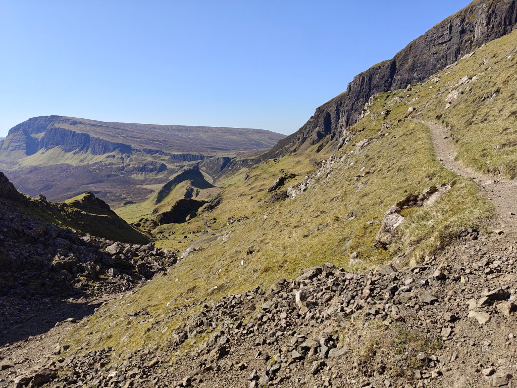
The path starts to head north again, running right along the edge of the ridgeline atop the dramatic cliff faces. Follow this well-defined trail as it gradually ambles to a lower elevation over rough stone until you reach a wooden stile in the fence on the right.
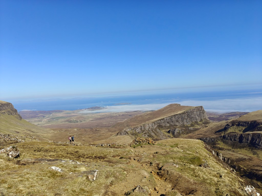
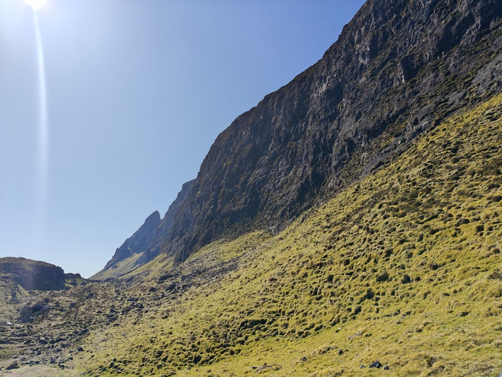
Climb over the stile, and then begin to navigate carefully down the path as the descent becomes much quicker and steeper for a short period before flattening out as you reach the bottom of the gorge between the cliffside you’ve just navigated down and the hill to the east.
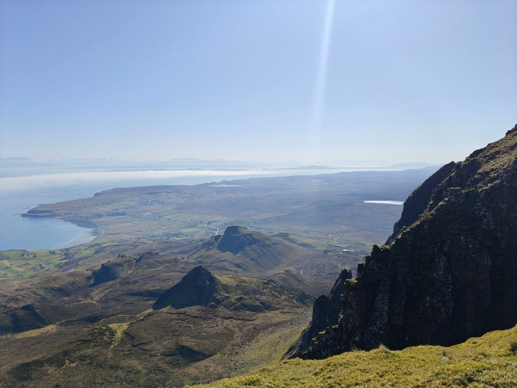
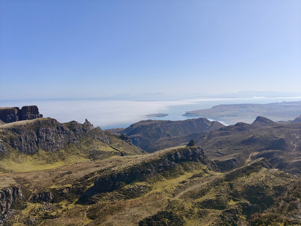
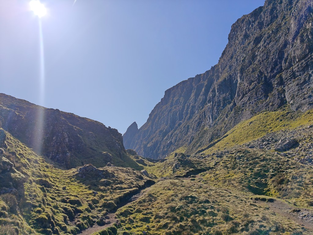
Follow the path as it winds through dramatic gorges, with the imposing cliff face consistently to your right. Eventually, the hills to your left suddenly drop away, revealing amazing, sweeping views to the east.
Continue along this narrow path, taking great care, as you will have to traverse a cliffside stream at least once. From this point, it is only a short, final walk back to your starting point at the Quiraing car park.


Leave a comment