| Altitude | 997 Feet |
| Trail Conditions | Well defined trail for first half, followed by a Quad Bike trail then off trail up hill. |
| Difficulty | Medium |
| Experience | 9/10 |
| Est. Time | 2-3 hours |
| Distance | 4-5 Miles |
| Starting Location | Navigate towards Struan, then follow small road back up the valley to Totardor. Follow the southern road to Totardor until you come to a farm house with a stile beside a gate to your right. |
History of the Local Area
Bracadale, meaning “Place where townships meet” in Norse, is a historic settlement you pass through on your way to the Glen Bracadale valley and Loch Bracadale. Established in the 1770s, Bracadale’s location was chosen for its ‘unspeakably secure’ access via Loch Bracadale, which forms one of the largest areas of semi-enclosed inshore waters around the Skye coast.
The people of Bracadale were once reputed to possess the faculty of “second sight” or psychic powers, a notable detail mentioned in an extract from The National Gazetteer in 1868.
As you approach Loch Duagrich, you’ll encounter a streamlet called Allt Beithe, or Birch Burn in Gaelic. This site is recorded as the location of a prehistoric hut circle dating from 4000 BC to 560 AD, which later became a shieling settlement. There don’t appear to be any public records regarding archaeological excavations of this site.
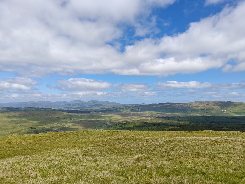
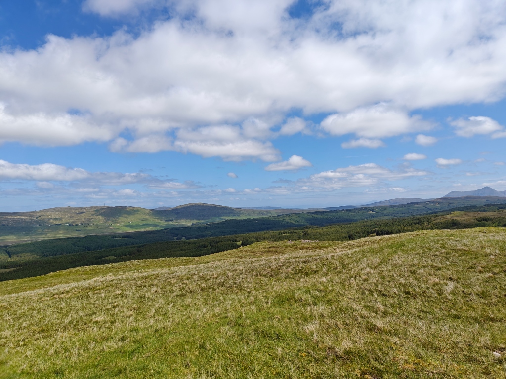
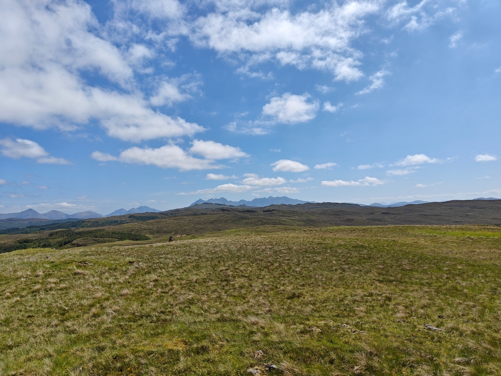
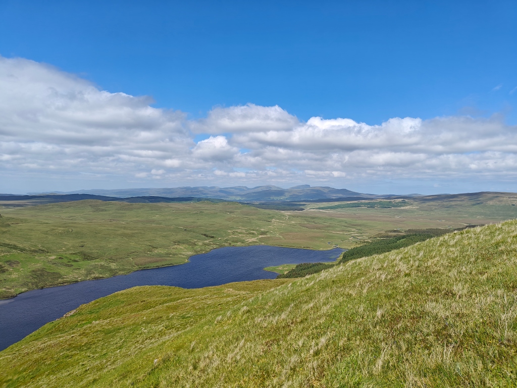
Gallery


The Walk
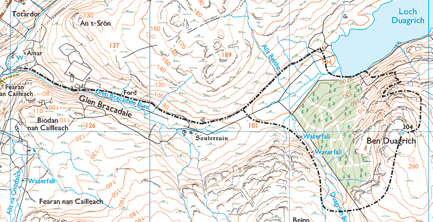
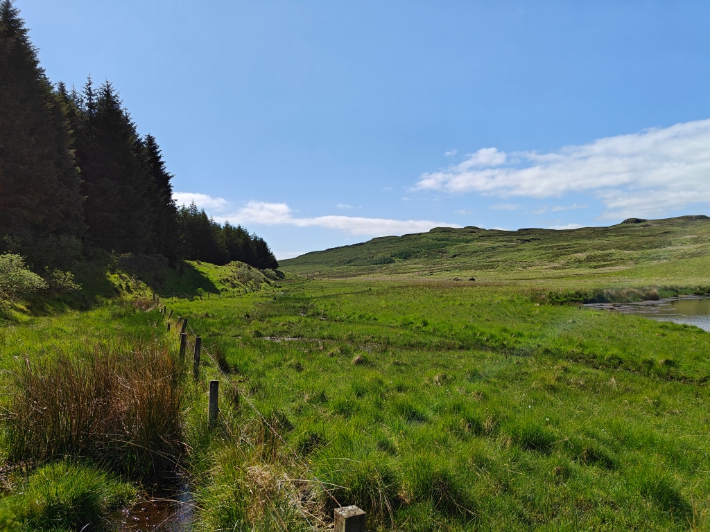
This trail begins at the farmstead of Totardor, a short drive or walk to the northeast of Struan. Following the river up the valley on the southern single track road, you will eventually come to a gate with a large stile on the right-hand side. Just before reaching the gate, there is a quarried area with space for a car or two.
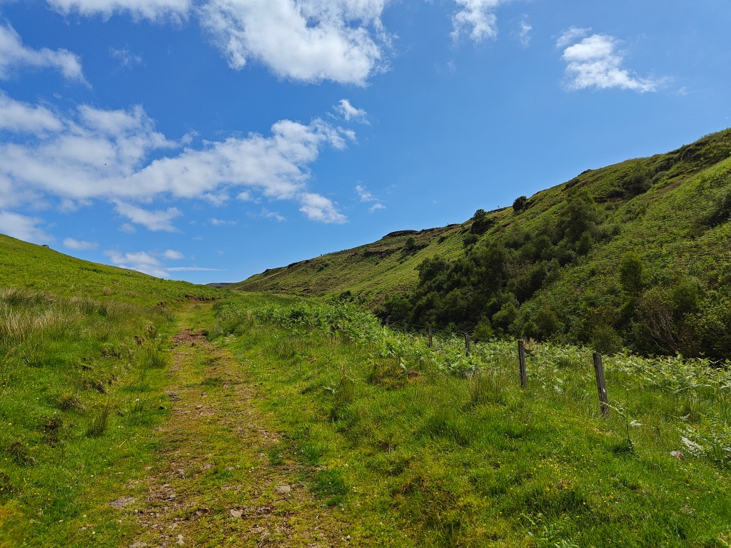
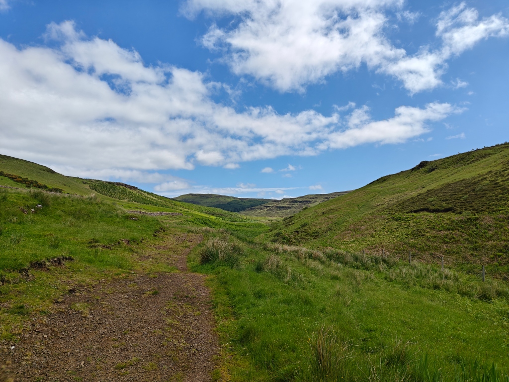
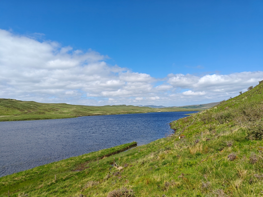
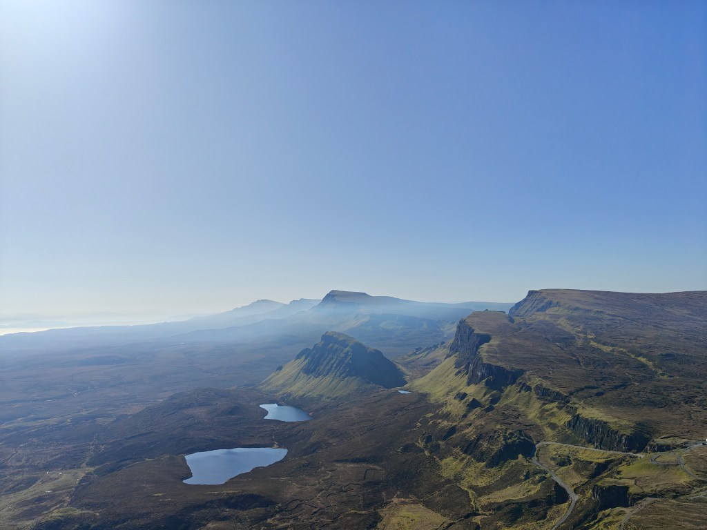
Once over the stile, you’ll enjoy a pleasant walk through the valley on an estate track for a little over a mile, bringing you within view of Loch Duagrich. From here, there are three potential routes to the Trig Point, two of which I attempted on the day.
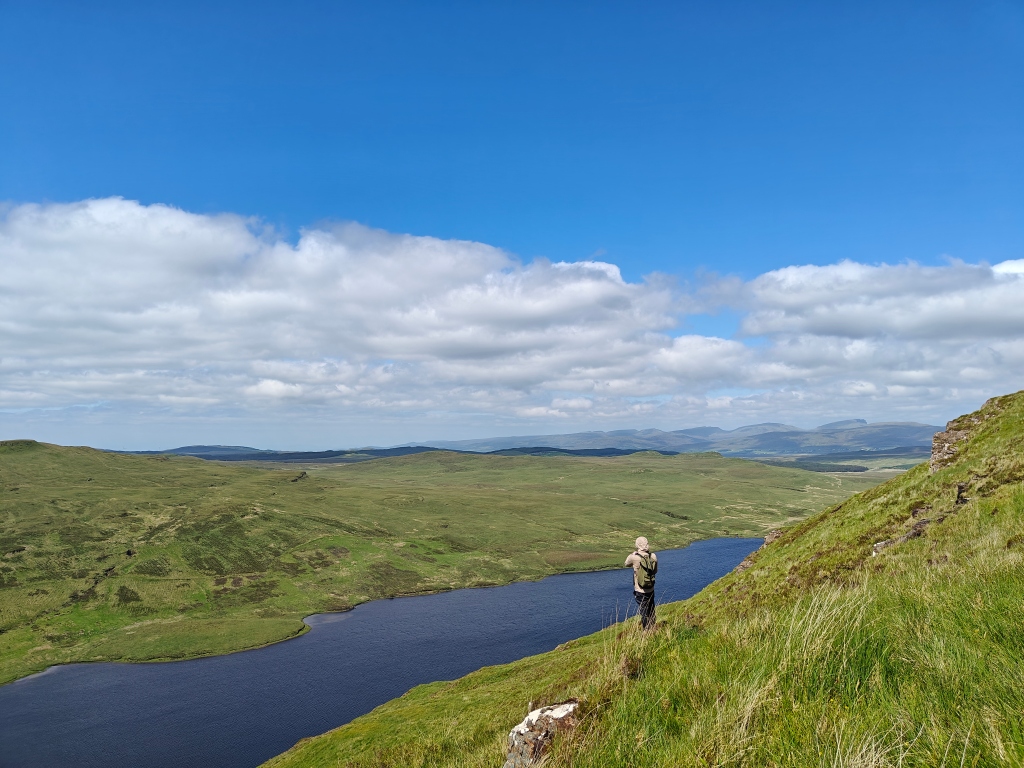
Via Loch Duagrich: Continue following the path towards Loch Duagrich. As the path begins to fade near the loch, you’ll reach another stile. Instead of crossing the fence, head south, skirting the bottom of Loch Duagrich. This requires crossing a fence without a stile. Once directly above the Trig Point, start ascending the mountain through bushes and often marshy ground. As you rise above the woodline on your right, the ground begins to firm up. The final summit is challenging and requires careful planning to avoid steep escarpments.
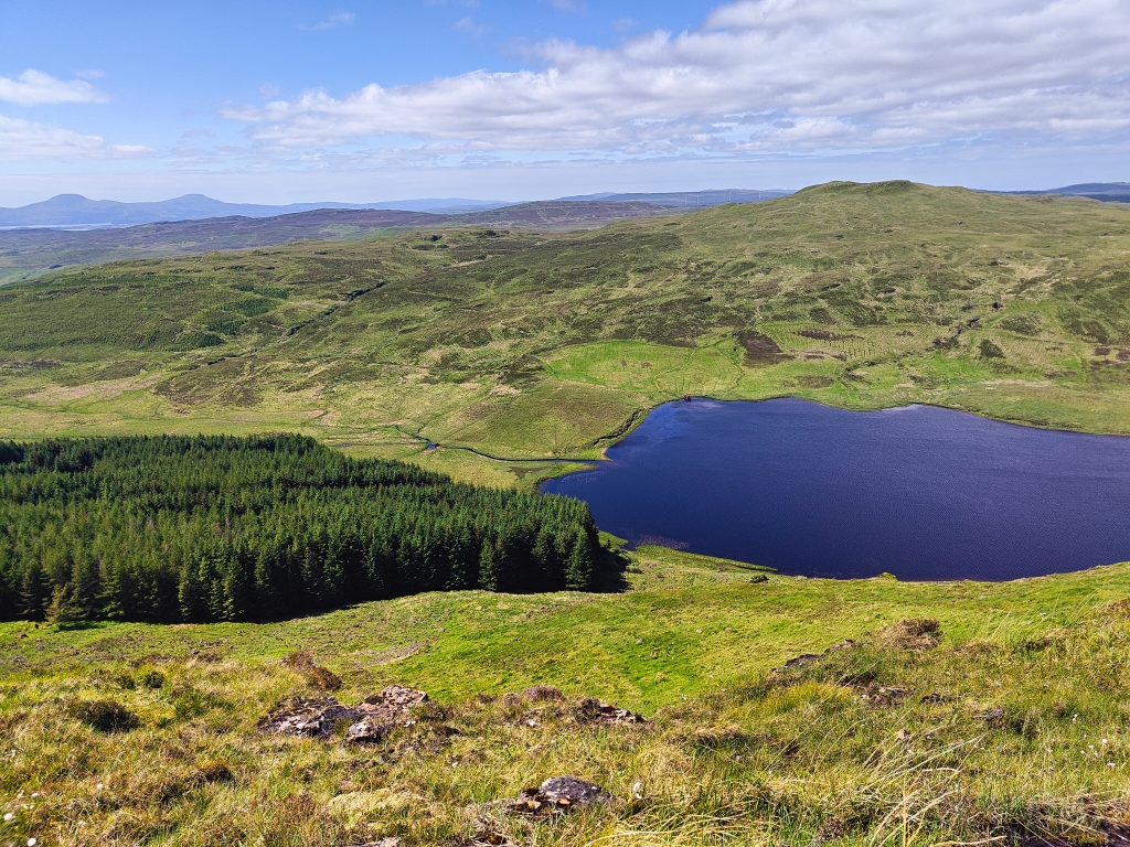
Via Beinn Sheilg: Take a rusted gate off to the right of the path, following a visible quad bike trail that winds up Beinn Sheilg via the Duagrich Burn. Follow this trail until you’re above the forestry, then cut back across the burn, cross a deer fence, and follow the Ben Duagrich ridgeline to the Trig Point. This route is easier to navigate but can be boggy.
Through the Forestry: While I haven’t tried this route, cutting directly through the forestry might be another option. It requires scaling at least two deer fences and involves a climb similar to the northern route.
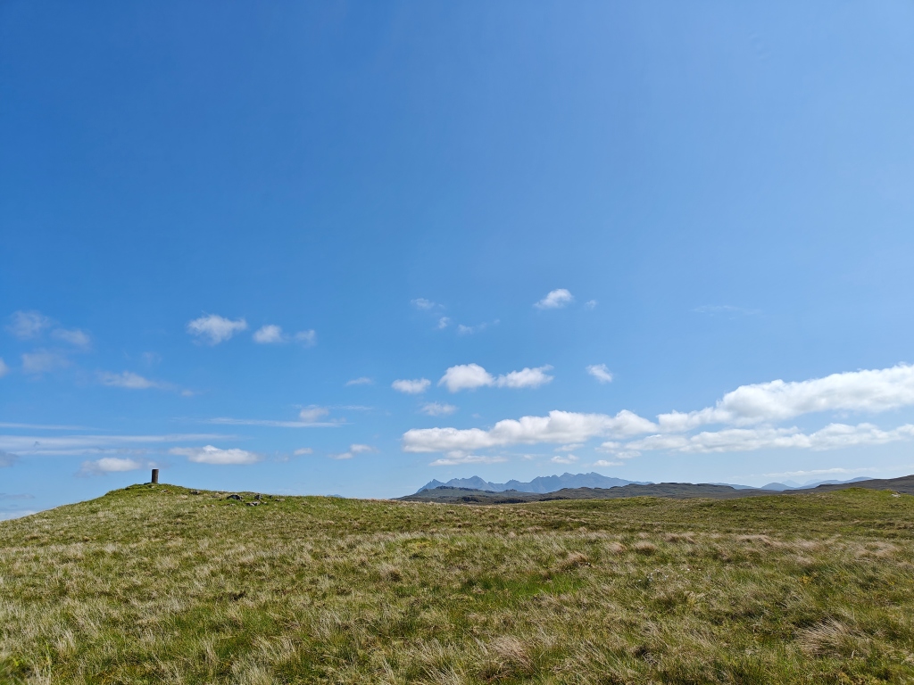
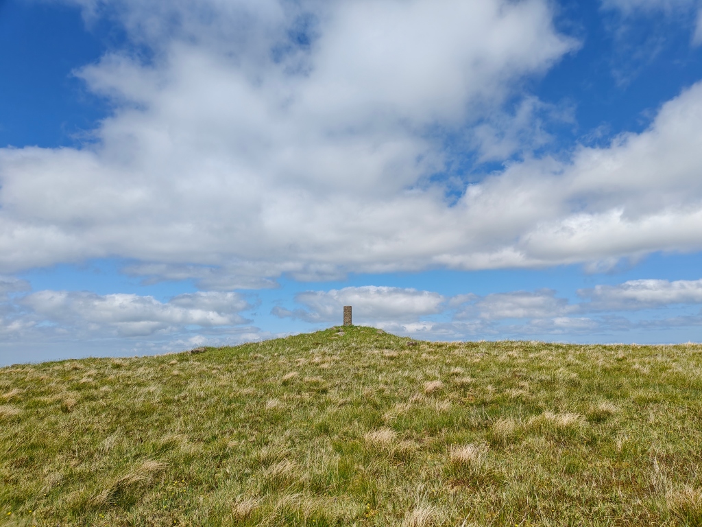
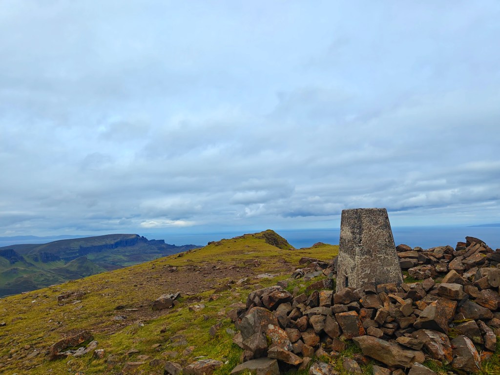
The Trig Point is situated on a small raised grass mound on a plateau stretching in many directions. From the Trig Point, you have clear views in every direction, including the Glenmore valley to the east, the Cuillins to the south, the islands of Wiay and Idrigill around Loch Bracadale to the west, and Borve to the north.
This is one of the more scenic locations I’ve encountered on Skye. I strongly suggest taking a short walk north from the Trig Point to view the entirety of Loch Duagrich.
The return journey to the starting gate is significantly easier. I recommend heading directly north down the face of the hill towards the loch, carefully planning your route to avoid large drops. Enjoy the stunning landscapes and rich history as you explore this beautiful part of Skye.


Leave a comment